Sautens
| Sautens | ||
|---|---|---|
 | ||
| ||
 Sautens Location within Austria | ||
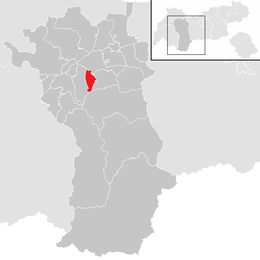
Location in the district
| ||
| Coordinates: 47°12′30″N 10°51′55″E / 47.20833°N 10.86528°ECoordinates: 47°12′30″N 10°51′55″E / 47.20833°N 10.86528°E | ||
| Country | Austria | |
| State | Tyrol | |
| District | Imst | |
| Government | ||
| • Mayor | Manfred Köll | |
| Area | ||
| • Total | 11.61 km2 (4.48 sq mi) | |
| Elevation | 812 m (2,664 ft) | |
| Population (1 January 2014)[1] | ||
| • Total | 1,485 | |
| • Density | 130/km2 (330/sq mi) | |
| Time zone | CET (UTC+1) | |
| • Summer (DST) | CEST (UTC+2) | |
| Postal code | 6432 | |
| Area code | 05252 | |
| Vehicle registration | IM | |
| Website | www.sautens.tirol.gv.at | |


Sautens Neue Pfarrkirche
Sautens is a municipality in the Imst district located 9 kilometres (6 mi) southeast of Imst on the lower course of the Ötztaler Ache. The village is located to catch the sun but is protected from the wind, which makes for an especially mild climate. The main source of income is agriculture. Fruit is especially important with a good part of the harvest used to make Schnapps.
The name of the village appears to originate from Roman times. Sautens was once connected with Oetz but became its own community in 1836. Recently the village has experienced increasing tourism.
Population
| Historical population | ||
|---|---|---|
| Year | Pop. | ±% |
| 1869 | 692 | — |
| 1880 | 657 | −5.1% |
| 1890 | 609 | −7.3% |
| 1900 | 559 | −8.2% |
| 1910 | 543 | −2.9% |
| 1923 | 604 | +11.2% |
| 1934 | 650 | +7.6% |
| 1939 | 654 | +0.6% |
| 1951 | 761 | +16.4% |
| 1961 | 792 | +4.1% |
| 1971 | 927 | +17.0% |
| 1981 | 1,081 | +16.6% |
| 1991 | 1,203 | +11.3% |
| 2001 | 1,280 | +6.4% |
| 2011 | 1,417 | +10.7% |
References
External links
| Wikimedia Commons has media related to Sautens. |
| ||||||