Satara (city)
- For the moth genus, see Satara (moth).
| Satara सातारा | |
|---|---|
| City | |
|
Clockwise from top: Chaarbhinti, Natraj Mandir, The name of the city 'Satara' in three different scripts: Modi, Devnagri and Latin; Kshetra Mahuli, Ajinkyatara Fort, and the panorama of Satara city. | |
| Nickname(s): Shahunagari | |
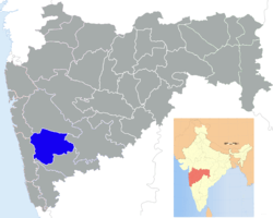
 Satara Location of Satara in Maharashtra | |
| Coordinates: 17°41′29″N 74°00′03″E / 17.69139°N 74.00092°ECoordinates: 17°41′29″N 74°00′03″E / 17.69139°N 74.00092°E | |
| Country |
|
| State | Maharashtra |
| District | Satara |
| Area | |
| • Total | 22.48 km2 (8.68 sq mi) |
| Elevation | 742 m (2,434 ft) |
| Population (2011) | |
| • Total | 326,789 |
| Demonym | Satarkar |
| Language | |
| • Official | Marathi |
| Time zone | IST (UTC+5:30) |
| PIN |
415001,415002,415003, 415004,415005,415006 |
| Telephone code | 02162 |
| Vehicle registration | MH-11 |
| Website |
www |

Satara (![]() pronunciation is a city located in the Satara District of Maharashtra state of India. The city is 2320 ft. above sea-level, near the confluence of the river Krishna and its tributary river Venna. The city was established in the 16th century and was the seat of Raja of Satara. This city is the headquarter of Satara Tahsil, as well as Satara District.
pronunciation is a city located in the Satara District of Maharashtra state of India. The city is 2320 ft. above sea-level, near the confluence of the river Krishna and its tributary river Venna. The city was established in the 16th century and was the seat of Raja of Satara. This city is the headquarter of Satara Tahsil, as well as Satara District.
History
Medieval
The first Muslim invasion of the Deccan took place in 1296. In 1636 the Nizam Shahi dynasty came to an end. In 1663 Shivaji conquered Parali and Satara fort. After death of Shivaji, Shahu Shivaji, Heir Apparent to Maratha Kingdom, captured by Mughals when we was only seven years old, remained their prisoner till the death of his father in 1700. The Dowager Maharani Tarabai proclaimed his younger half-brother, and her son, Shahu Sambhaji as Chhatrapati Maharaj under her regency. Mughals released Shahu with some conditions in 1707, so that Marathas would face an internal war for the throne. Shahu returned to Maratha empire and claimed his inheritance. Aurangzeb's son Muhammad Azam Shah conquered Satara fort (Ajinkyatara) after a 6 month siege, later won by Parshuram Pratinidhi in 1706. In 1708 Chattrapati Shahu, the son of Chhatrapati Sambhaji, was crowned on the Satara fort. The direct descendents of Raja Shivaji continue to live in Satara. Udayanraje Bhonsle is the 13th descendent of Shivaji Maharaj.Dundle is the Sardar Of Chhatrpati Shivaji Maharaj. [1]
Dr. B.R.Ambedkar writes about his experience while livign as a child in Satara in his autobiographical book, Waiting for a Visa (chapter 1).[2]
Features
- Satara is well known for its sweet: kandi pedhe.
- This city was one of the capitals of the Maratha Empire.
- Also, this city was one of the centers of Indian Independence Movement.
- It is situated near confluence of two rivers: Krishna and Venna.
- Satara City has a unique statue of Shivaji standing near a canon at Powai Naka; most of the statues elsewhere depict Shivaji riding on a horse.
- Kas plateau / Flower plateau is now a World Natural Heritage site.[3]
- The scheme of Insurance was also started in satara by vimamaharshi Annasaheb Chirmulyani.
- Satara city consists of junction known as powai naka where 8 roads meet .
- India's first Sainik School is also located in Satara city.
Geography

Satara is located at 17°41′N 73°59′E / 17.68°N 73.98°E.[4] It has an average elevation of 742 metres (2434 feet).
It is located on National Highway 4, between Karad and Khandala.[5]
Climate
Satara City is surrounded by seven hills. Since it is in hilly area, its climate is tropical wet and dry. The temperature of Satara City is varies in the range 33 °C-38 °C in Summer and 5 °C-20 °C in winter. Due to Monsoon, we can experience the rainy season between the period June to early October. In this area, near about 1000 mm rainfall occurs during monsoon.
| Climate data for Satara | |||||||||||||
|---|---|---|---|---|---|---|---|---|---|---|---|---|---|
| Month | Jan | Feb | Mar | Apr | May | Jun | Jul | Aug | Sep | Oct | Nov | Dec | Year |
| Average high °C (°F) | 29.5 (85.1) |
30.8 (87.4) |
34.6 (94.3) |
36.3 (97.3) |
34.8 (94.6) |
29.4 (84.9) |
25.4 (77.7) |
25.7 (78.3) |
27.2 (81) |
30.2 (86.4) |
28.6 (83.5) |
28.4 (83.1) |
30.08 (86.13) |
| Average low °C (°F) | 12.9 (55.2) |
15.8 (60.4) |
19.2 (66.6) |
21.7 (71.1) |
22.8 (73) |
21.8 (71.2) |
21.1 (70) |
20.5 (68.9) |
20.1 (68.2) |
19.7 (67.5) |
16.7 (62.1) |
11.4 (52.5) |
18.64 (65.56) |
| Average precipitation mm (inches) | 3.1 (0.122) |
1.3 (0.051) |
3.3 (0.13) |
18.3 (0.72) |
34.8 (1.37) |
134.4 (5.291) |
370.3 (14.579) |
296.9 (11.689) |
125.0 (4.921) |
81.5 (3.209) |
49.3 (1.941) |
6.9 (0.272) |
1,125.1 (44.295) |
| Source: Government of Maharashtra | |||||||||||||
Tourism


The famous tourist points near Satara City are:
- Ajinkyatara Fort (अजिंक्यतारा किल्ला)
- Chandan Vandan Fort
- Sajjangad Fort (सज्जनगड किल्ला)


- Chaphal [Shree Ram Mandir, Near Patan][6]
Demographics
As of 2011 India census,[7] Satara had a population of 120,079; males constituted 52% of the population and females 48%. Satara has an average literacy rate of 80%, higher than the national average of 74%: male literacy is 84%, and female literacy is 76%. In Satara, 10% of the population is under 6 years of age. Marathi is the native & widely spoken languages.English,Kannada,Gujarati are also spoken.
Maharashtra state's sex ratio is 883 girls per 1000 boys, and Satara fares worse still at 881, in spite of the high level of literacy.[8]
See also
References
- ↑ http://www.royalark.net/India4/satara.htm
- ↑ Ambedkar, Dr. Bhimrao (1991). Waiting for a Visa (PDF). Mumbai: Dept. of education, Government of Maharashtra. pp. 4071–4090. Retrieved 15 April 2015.
- ↑ 3.0 3.1 Mulla, Mohsin (4 July 2012). "Kaas to bloom for only 2,000 tourists daily". Dnaindia.com.
- ↑ Falling Rain Genomics, Inc – Satara.
- ↑ "Satara District Map". mapsofindia.com. Retrieved 31 March 2015.
- ↑ Chaphal details. virajtravels.in
- ↑ Cities having population 1 lakh and above. censusindia.gov.in
- ↑ Babu, Chaya. 285 Indian girls no longer called "unwanted". Associated Press via MSNBC. 22 October 2011
Further reading
- Paul H. von Tucher: Nationalism: Case and crisis in Mission – German Missions in British India 1939 – 1946 Diss. Erlangen 1980. Author's edition Erlangen/Germany 1980. Read SATARA.
- Wilhelm Filchner: Life of a Researcher (chapter XXIII). Wilhelm Filchner was interned from September 1941 until November 1946 in the Parole Camp in Satara.
- Selections from the Historical Records of the Hereditary Minister of Baroda. Consisting of letters from Bombay, Baroda, Poona and Satara Governments. Collected by B. A. Gupte. Calcutta 1922.
- Malik, S. C. Stone Age Industries of the Bombay & Satara Districts, M. Sayajirao University Baroda 1959.
- Irawati Karve, Jayant Sadashiv Randadive, The Social Dynamics of a Growing Town and Its Surrounding Area. Deccan College, 1965, Poona. ISBN B0000CQW3J
- Valunjkar, T. N. Social Organization, Migration & Change in a Village Community, Deccan College Poona 1966.
External links
| Wikimedia Commons has media related to Satara. |
![]() This article incorporates text from a publication now in the public domain: Chisholm, Hugh, ed. (1911). Encyclopædia Britannica (11th ed.). Cambridge University Press.
This article incorporates text from a publication now in the public domain: Chisholm, Hugh, ed. (1911). Encyclopædia Britannica (11th ed.). Cambridge University Press.
| ||||||||||||||||||||||||||||||||||||||||||||||||||||
| ||||||||||||||||||||||||||||||||||||||||||||||||||||||||