Saskatchewan Highway 155
| ||||
|---|---|---|---|---|
| Route information | ||||
| Length: | 299 km (186 mi) | |||
| Existed: | 1947 – present | |||
| Major junctions | ||||
| From: |
| |||
| To: |
| |||
| Highway system | ||||
|
Provincial highways in Saskatchewan
| ||||
.svg.png)
Highway 155 is a paved undivided highway in the Canadian province of Saskatchewan. It runs from Highway 55 near Green Lake until La Loche, where it intersects with Highway 955. Highway 155 is about 299 km (186 mi.) long.
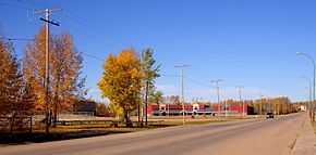
Communities accessible directly from Highway 155 are Green Lake, Buffalo Narrows, Landing, Bear Creek, and La Loche.
Many provincial recreation sites are also accessible from Highway 155.
Highway 155 connects with Highway 55, Highway 165, Highway 965, Highway 908, Highway 925, Highway 909, Highway 956, and Highway 955.
History
"No. 155 Highway was begun in 1947 as a development road".
It reached Buffalo Narrows in 1957 where a ferry was needed to cross the Kisis Channel.
"The new road follows closely the old wagon trail cut 100 years earlier by the HBC." (Star-Phoenix-Aug.29.1963)[1]
The official opening of Highway 155 from Green Lake to Buffalo Narrows was held in August 1963 in Green Lake. The old trail to La Loche was rebuilt soon after to become part of Highway 155.
A bridge now crosses the Kisis Channel next to where the ferry was once located. The Kisis Channel connects Churchill Lake to Peter Pond Lake.
In the 1980s the highway was straightened and paved.
| Distances from km 0[2] | Highways off Hwy 155 | notes | Destinations on and off Hwy 155 |
|---|---|---|---|
| km 0 | Hwy 55 | Highway 155 begins in | Green Lake |
| km 94 | Hwy 165 | Stop...turn left to continue on Hwy 155 | going straight leads to Beauval |
| km 99 | Hwy 965 | junction | turn left to Canoe Narrows |
| km 154 | Hwy 908 | junction | turn right to Ile a la Crosse |
| km 186 | Hwy 925 | junction | turn left to Dillon |
| km 194 | access road | turn right to Buffalo Narrows Airport | |
| km 199 | centre | Buffalo Narrows | |
| km 204 | access road | turn left to Sand Dunes Park | |
| km 255 | Hwy 909 | junction | turn right to Turnor Lake |
| km 259 | centre | Bear Creek | |
| km 288 | Hwy 956 | junction | turn left to Black Point and Garson Lake |
| km 299 | Hwy 955 | junction | turn right to Cluff Lake mine |
| km 300 | Highway 155 ends | La Loche | |
References
- ↑ Dunfield, H. C. "Northernmost Highway Serves Historic Frontier Area". Star-Phoenix (Saskatoon). pp. 8 (1963–08–20).
- ↑ https://maps.google.com/
| ||||||||||||||||||||||||||