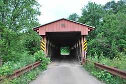
Sarvis Fork Covered Bridge
|
Sarvis Fork Covered Bridge | |
 | |
|
Sarvis Fork Covered Bridge, June 2009 | |
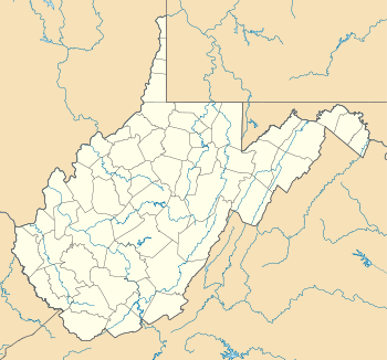 | |
| Location | County Route 21/15, near Sandyville, West Virginia |
|---|---|
| Coordinates | 38°55′17″N 81°38′41″W / 38.92139°N 81.64472°WCoordinates: 38°55′17″N 81°38′41″W / 38.92139°N 81.64472°W |
| Area | less than one acre |
| Built | 1889 |
| Architect | Quincy,J. Grim; Cunningham,R.B. |
| Architectural style | Long Truss |
| Governing body | State |
| MPS | West Virginia Covered Bridges TR |
| NRHP Reference # |
81000602 [1] |
| Added to NRHP | June 4, 1981 |
Sarvis Fork Covered Bridge, also known as Sandyville Covered Bridge, is a historic covered bridge located near Sandyville, Jackson County, West Virginia. It was built in 1889-1890 for $64.00 by R. B. Cunningham and G.W. Staats, originally spanning John Carnahan's Fork, a branch of Mill Creek. When State Route 33 was built using an iron bridge the covered bridge was first abandoned then moved and rebuilt over the left fork of the Sandy River for $1,050.00. The bridge was completely rebuilt in 2000.[2] It measures 101 feet, 3 1/2 inches, in length and 11 feet, 8 inches wide.[3]
It was listed on the National Register of Historic Places in 1981.[1]
References
- ↑ 1.0 1.1 "National Register Information System". National Register of Historic Places. National Park Service. 2009-03-13.
- ↑ http://www.transportation.wv.gov/communications/bridge_facts/covered-bridges/Pages/SarvisFork.aspx
- ↑ E. L. Kemp (n.d.). "National Register of Historic Places Inventory Nomination Form: Sarvis Fork Covered Bridge". State of West Virginia, West Virginia Division of Culture and History, Historic Preservation. Retrieved 2011-06-20.
| |||||||||||||||||||||
