Sarufutsu, Hokkaido
| Sarufutsu 猿払村 | |
|---|---|
| Village | |
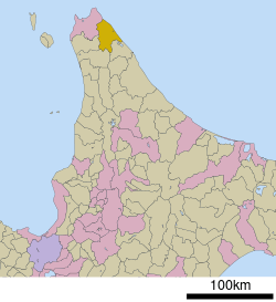 Location of Sarufutsu in Hokkaido (Sōya Subprefecture) | |
 Sarufutsu Location in Japan | |
| Coordinates: 45°20′N 142°7′E / 45.333°N 142.117°ECoordinates: 45°20′N 142°7′E / 45.333°N 142.117°E | |
| Country | Japan |
| Region | Hokkaido |
| Prefecture | Hokkaido (Sōya Subprefecture) |
| District | Sōya |
| Area | |
| • Total | 590.00 km2 (227.80 sq mi) |
| Population (December 31, 2007) | |
| • Total | 2,822 |
| • Density | 4.8/km2 (12/sq mi) |
| Time zone | Japan Standard Time (UTC+9) |
| Symbols | |
| - Tree | Rowan |
| - Flower | Vaccinium vitis-idaea |
| Address |
172 Onishibetsu-nishi, Sarufutsu-mura, Hokkaidō 098-6292 |
| Phone number | 01635-2-3131 |
| Website | Village of Sarufutsu |
Sarufutsu (猿払村 Sarufutsu-mura) is a village located in Sōya District, Sōya Subprefecture, Hokkaido, Japan.
As of September 2014, the village has an estimated population of 2,884 and a density of 4.91 persons per km². The total area is 590.00 km².
Geography
Sarufutsu is the northernmost village in Japan and is the largest village in Hokkaido in area. Located on the Tonbetsu Plain, it faces the Sea of Okhotsk to the east where, during the winter, there is drift ice. [1] 80% of the village's total area is covered by forests.
- Mountains: Mount Horoshiri
- Rivers: Sarufutsu River
- Lakes: Poro Swamp, Kamuito Swamp, Mokeuni Swamp
Settlements/Localities in Sarufutsu
- Ashino (芦野)
- Asajino (浅茅野)
- Chiraibetsu (知来別)
- Hamaonishibetsu (浜鬼志別)
- Hamasarufutsu (猿払村)
- Onishibetsu (鬼志別)(Town Hall is located here)
Neighbouring municipalities
Economy
Sarufutsu is famous for its large and particularly excellent scallops, among other seafood. Likewise, a relatively large part of the village is utilized for dairy farming. Sarufutsu has a fledgling tourist industry, as it is a highlight for motor bikers in the summer, who stop overnight at one of the biker camps. The tourist center is located a few kilometers south of Hamaonishibetsu.
Education
- Primary Schools
- Onishibestu Elementary School
- Hamaonishibestu Elementary School
- Hamasarufutsu Elementary School(Closed starting Spring 2015)
- Asajino Elementary School
- Ashino Elementary School
- Junior High Schools
- Takushin Junior High School
Recreation
- Onishibetsu Sports Center has weekly sports activities for residents and guests.
Summer
- Onishibetsu swimming pool is open during the summer into early fall.
Winter
- Onishibetsu has a small single-lift ski hill.
References
- ↑ 考える社会科地図 Kangaeru Shakaika Chizu. 四谷大塚出版 Yotsuya-Ōtsuka Shuppan. 2005. p. 81.
External links
![]() Media related to Sarufutsu, Hokkaidō at Wikimedia Commons
Media related to Sarufutsu, Hokkaidō at Wikimedia Commons
- Sarufutsu official website (Japanese)