Sargodha
| Sargodha City of Eagles | |
|---|---|
| Metropolitan | |
 | |
| Nickname(s): California of Pakistan | |
 Sargodha | |
| Coordinates: 32°5′1″N 72°40′16″E / 32.08361°N 72.67111°ECoordinates: 32°5′1″N 72°40′16″E / 32.08361°N 72.67111°E | |
| Country | Pakistan |
| Province | Punjab |
| District | Sargodha |
| Area | |
| • Metropolitan | 5,854 km2 (2,260 sq mi) |
| Population (14th August 2014)[1] | |
| • Metropolitan | 4,557,514 |
| • Rank | 8th,Pakistan |
| • Density | 1,855/km2 (4,800/sq mi) |
| • Urban | 1,845,812 |
| Time zone | PST (UTC+5) |
| Calling code | 048 |
| Number of towns | 59 |
| Number of union councils | 22 |
Sargodha (Punjabi, Urdu: سرگودها) is a city and the administrative centre of the Sargodha Division located in the Punjab province, Pakistan.Sargodha is 8th in the List of most populous cities in Pakistan and is located in the north-east of the country.
History
The origins of this city are quite old but the proper town was established by the British in 1903.[2] Although it was a small town in the beginning, the British Royal Air Force built an airport here due to its strategic location.[3]
Geography
Sargodha is located 172 kilometres west of Lahore, in the Sargodha District. Sargodha is located roughly 94 km northwest of Faisalabad. Sargodha consists of flat plains although there are few small hills on the Sargodha-Faisalabad Road.
Climate
The city has a climate of extreme heat in the summers and moderate cold in the winters. The maximum temperature reaches 50 °C (122 °F) in the summer while the minimum temperature recorded is as low as freezing point in the winter.
| Climate data for Sargodha (1960–2012) | |||||||||||||
|---|---|---|---|---|---|---|---|---|---|---|---|---|---|
| Month | Jan | Feb | Mar | Apr | May | Jun | Jul | Aug | Sep | Oct | Nov | Dec | Year |
| Average high °C (°F) | 20 (68) |
22 (72) |
26 (79) |
32 (90) |
38 (100) |
39 (102) |
38 (100) |
37 (99) |
36 (97) |
32 (90) |
26 (79) |
22 (72) |
30.6 (87.1) |
| Average low °C (°F) | 8 (46) |
11 (52) |
15.5 (59.9) |
19 (66) |
25 (77) |
27 (81) |
26 (79) |
26 (79) |
25 (77) |
20 (68) |
14 (57) |
9 (48) |
18.8 (65.8) |
| Average precipitation mm (inches) | 18 (0.71) |
36 (1.42) |
24 (0.94) |
13 (0.51) |
17 (0.67) |
48 (1.89) |
82 (3.23) |
87 (3.43) |
43 (1.69) |
9 (0.35) |
11 (0.43) |
12 (0.47) |
400 (15.74) |
| Avg. precipitation days (≥ 1.0 mm) | 5 | 4 | 5 | 4 | 3 | 3 | 7 | 7 | 4 | 1 | 1 | 1 | 45 |
| Source: Weather2,[4] | |||||||||||||
Demographics
Total population of the city was 957,514[1] according to the 1998 census. The majority of the people in the city speak Punjabi.[3]
Administration
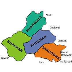
Sargodha is the capital of Sargodha Tehsil. As of October 2012, the division system in Punjab Province has been restored and Sargodha became the divisional headquarters of districts Sargodha, Khushab, Mianwali and Bhakkar. The city of Sargodha is administratively subdivided into 22 union councils.[5]
Local features
Sargodha lies about 30 miles from the M-2 motorway which connects Lahore and Islamabad. It is also connected to Faisalabad by a highway. Daewoo Bus Service drives regular routes from Sargodha to the rest of the country. Sargodha is also connected by the rest of the country through the rail. Sargodha Junction railway station is located on Shorkot-Lala Musa branch railway line. Sargodha is home to the Sargodha Cricket Stadium.
Mushaf Air Base
Pakistan's largest airbase, PAF Base Mushaf (formerly PAF Base Sargodha), is situated in Sargodha and hosts the headquarters of the Pakistan Air Force's Central Air Command. The airbase is also home to the Combat Commanders School (CCS), formerly the Fighter Leader's School.
Notable people
- Feroz Khan Noon (Former Prime Minister Pakistan)
- Anwer Ali Noon (Former Parliamentarian of Pakistan, Politician-PPP, Officer in the British Indian Army and Pakistan Army)
- Amjad Ali Noon (Former Ambassador/High Commissioner of Pakistan(for Kenya, Uganda, Mozambique), Zila Nazim Sargodha, Member of Parliament, Chairman State Cement Corporation, Chairman Prime Minister Inspection Commission)
- Imtiaz Bhatti (Former Ambassador / High Commissioner of Pakistan for Burundi, Madagascar, Malawi and Tanzania)
- Wazir Agha (Urdu Scholar)
- Hameed Gul (Former ISI Chief)
- Ch. Anwar Ali Cheema (Politician, PML-Q)
- Ch.Ghias Mela (Politician, PML-Q)
- Hafiz Muhammad Saeed (Amir Jama'at-ud-Da'wah)
- Mohammad Hafeez (Pakistani cricketer)
- Aizaz Cheema (Pakistani cricketer)
- Rafiq Anjum (ptv drama Actor)
- Jahanzeb Qamar (PTV AWARDED, Drama Writer)
References
- ↑ 1.0 1.1 http://census.gov.pk/MajorCities.htm
- ↑ http://www.tdcp.gop.pk/tdcp/ExplorePakistan/AboutPunjab/MajorCities/Sargodha/tabid/245/Default.aspx
- ↑ 3.0 3.1 http://sargodha.dc.lhc.gov.pk/?page_id=1335
- ↑ "Weather2 – Sargodha". Retrieved 8 July 2012.
- ↑ "Tehsils & Unions in the District of Sargodha - Government of Pakistan". Nrb.gov.pk. Retrieved 2012-03-15.