Santuario, Risaralda
Coordinates: 5°4′20.87″N 75°57′44.45″W / 5.0724639°N 75.9623472°W
| Santuario, Risaralda | |
|---|---|
| Municipality and town | |
| Nickname(s): Pearl of The Tatamá | |
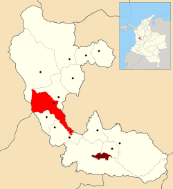 Location of the municipality and town of Santuario, Risaralda in the Risaralda Department of Colombia. | |
| Country |
|
| Department | Risaralda Department |
| Area | |
| • Municipality and town | 226 km2 (87 sq mi) |
| Elevation | 1,565 m (5,135 ft) |
| Population | |
| • Urban | 14,736 |
| Time zone | Colombia Standard Time (UTC-5) |
Santuario (elevation 1575 m[1]) is a town and municipality in the Department of Risaralda, Colombia.
Tourism
One of the main characteristics of the town is the yearly observance of religious holidays and local fairs.
Sites of interest
- Tatama’s National Park
- Maria Inmaculada’s Church
- Calle Real
References
| ||||||||