Santo Antônio do Palma
| Map | |
|---|---|
 | |
| Statistics | |
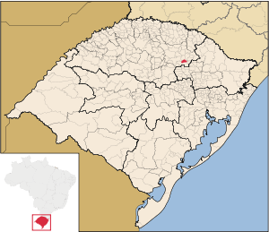
| State: | Rio Grande do Sul |
| Meso-region: | Westcentral Rio Grande do Sul (Centro Ocidental Rio-Grandense) |
| Micro-Region: | Passo Fundo |
| Founded: | March 20, 1992 |
| Location: | 28.4975/28° 29' 49" S lat. 53.3408/53° 1' 29" W long. |
| Area: | 126.11 km² |
| Population (2003): - Total - Change - Density | 2,177 - 17.26/km² |
| Elevation: | 669 m |
| Postal code: | 99265-xxx |
| Website: | www.stoantoniopalma.rs.gov.br |
| Politics | |
| Mayor: | --> |
Santo Antônio do Palma (first part, Portuguese meaning "Saint Anthony", last part meaning palm) is a municipality of the central part of the state of Rio Grande do Sul, Brazil. Its area is 120.11 km² and its population was 2,711 in 2003. Its elevation is at 669 m.
External links
- http://www.citybrazil.com.br/rs/stoantoniopalma/ (Portuguese)
- Map and Aerial photos:
- Coordinates: 28°59′49″S 53°1′29″W / 28.99694°S 53.02472°W
- Street maps: Street map from Mapquest, MapPoint or Google
- Satellite images and Aerial photos: Google
