Santa Rosa Plateau


The Santa Rosa Plateau is an upland plateau and southeastern extension of the Santa Ana Mountains in Riverside County, southern California. It is bounded by the rapidly urbanizing Inland Empire cities of Murrieta to the northeast, and Temecula to the southeast.
The Santa Rosa Plateau Ecological Reserve preserves approximately 8,400 acres (34 km2) of the plateau, and includes the Moreno and Machado Adobes, Riverside County’s oldest standing structures, and other buildings from the 19th century Mexican land grant Rancho Santa Rosa.[1]
Habitats
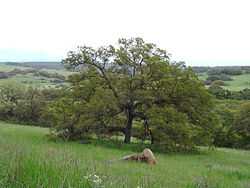
The Santa Rosa Plateau is home to several native plant communities and habitats, including purple needlegrass prairie (Nassella pulchra), California oak woodland (Engelmann Oaks—Quercus engelmannii), montane chaparral, coastal sage scrub, and vernal pools, which are increasingly rare in urbanized Southern California.
Ecological Reserve

The Santa Rosa Plateau Ecological Reserve was assembled in several stages; two parcels, comprising 3,100 acres (13 km2), were purchased by The Nature Conservancy in 1984. The intervening parcels were purchased in the 1990s by the State of California, the Riverside County Regional Park and Open Space District, and the Metropolitan Water District of Southern California.
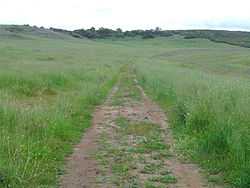
Although the parcels remain under the ownership of separate agencies, they are managed cooperatively, with biological resource management, which includes prescribed fire and habitat restoration programs managed by the Nature Conservancy, and visitor management. This includes operation of a visitor center and a 40-mile (60 km) trail system, managed by the Riverside County Regional Park and Open-Space District (RivCo Parks).
See also
References
External links
| Wikimedia Commons has media related to Santa Rosa Plateau. |
Coordinates: 33°32′36″N 117°16′10″W / 33.54336°N 117.26952°W