Santa Marcela, Apayao
| Santa Marcela | |
|---|---|
| Municipality | |
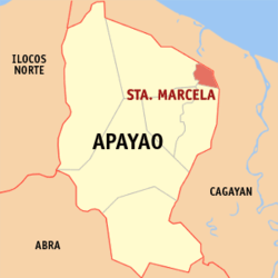 Map of Apayao showing the location of Santa Marcela | |
.svg.png) Sta. Marcela Location within the Philippines | |
| Coordinates: 18°17′N 121°26′E / 18.283°N 121.433°ECoordinates: 18°17′N 121°26′E / 18.283°N 121.433°E | |
| Country | Philippines |
| Region | Cordillera Administrative Region (CAR) |
| Province | Apayao |
| District | Lone District |
| Barangays | 13 |
| Government[1] | |
| • Mayor | Rolly U. Guiang |
| Area[2] | |
| • Total | 196.32 km2 (75.80 sq mi) |
| Population (2010)[3] | |
| • Total | 12,010 |
| • Density | 61/km2 (160/sq mi) |
| Time zone | PST (UTC+8) |
| ZIP code | 3811 |
| Dialing code | 74 |
| Income class | 5th class |
Santa Marcela is a fifth class municipality in the province of Apayao, Philippines. According to the 2010 census, it has a population of 12,010 people.[3]
Santa Marcela and Pudtol were originally territories of Luna before they gained their own municipal status.
Barangays
Santa Marcela is politically subdivided into 13 barangays.[2]
- Barocboc
- Consuelo
- Imelda (Sipa Annex)
- Malekkeg
- Marcela (Pob.)
- Nueva
- Panay
- San Antonio
- Sipa Proper
- Emiliana
- San Carlos
- San Juan
- San Mariano
Demographics
| Population census of Santa Marcela | ||
|---|---|---|
| Year | Pop. | ±% p.a. |
| 1990 | 7,622 | — |
| 1995 | 8,718 | +2.55% |
| 2000 | 9,856 | +2.67% |
| 2007 | 11,731 | +2.43% |
| 2010 | 12,010 | +0.86% |
| Source: National Statistics Office[3] | ||
In popular culture
- In Fernando Poe Jr.'s film,Ang Probinsiyano,he acts as the town's Chief of Police before relocated to Manila to investigate who killed his twin brother,who is also a policeman.
References
- ↑ "Official City/Municipal 2013 Election Results". Intramuros, Manila, Philippines: Commission on Elections (COMELEC). 11 September 2013. Retrieved 2 January 2014.
- ↑ 2.0 2.1 "Province: APAYAO". PSGC Interactive. Makati City, Philippines: National Statistical Coordination Board. Retrieved 2 January 2014.
- ↑ 3.0 3.1 3.2 "Total Population by Province, City, Municipality and Barangay: as of May 1, 2010". 2010 Census of Population and Housing. National Statistics Office. Retrieved 2 January 2014.
External links
 |
Abulug, Cagayan | Ballesteros, Cagayan | | |
| Luna | |
Allacapan, Cagayan | ||
| ||||
| | ||||
| Flora |
| ||||||||||||||