Santa Josefa, Agusan del Sur
| Santa Josefa | |
|---|---|
| Municipality | |
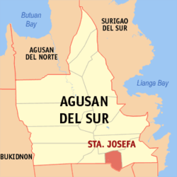 Map of Agusan del Sur with Santa Josefa highlighted | |
.svg.png) Santa Josefa Location within the Philippines | |
| Coordinates: 07°59′N 126°02′E / 7.983°N 126.033°ECoordinates: 07°59′N 126°02′E / 7.983°N 126.033°E | |
| Country | Philippines |
| Region | Caraga (Region XIII) |
| Province | Agusan del Sur |
| District | 2nd district of Agusan del Sur |
| Barangays | 11 |
| Government[1] | |
| • Mayor | Jann Roby R. Otero |
| Area[2] | |
| • Total | 341.80 km2 (131.97 sq mi) |
| Population (2010)[3] | |
| • Total | 25,156 |
| • Density | 74/km2 (190/sq mi) |
| Time zone | PST (UTC+8) |
| ZIP code | 8512 |
| Dialing code | 85 |
| Income class | 3rd |
Santa Josefa is a third class municipality in the province of Agusan del Sur, Philippines. According to the 2010 census, it has a population of 25,156 people.[3]
Barangays
Santa Josefa is politically subdivided into 11 barangays.[2]
- Angas
- Aurora
- Awao
- Concepcion
- Pag-asa
- Patrocinio
- Poblacion
- San Jose
- Santa Isabel
- Sayon
- Tapaz
Demographics
| Population census of Santa Josefa | ||
|---|---|---|
| Year | Pop. | ±% p.a. |
| 1990 | 24,004 | — |
| 1995 | 21,190 | −2.31% |
| 2000 | 22,730 | +1.52% |
| 2007 | 24,972 | +1.31% |
| 2010 | 25,156 | +0.27% |
| Source: National Statistics Office[3] | ||
References
- ↑ "Official City/Municipal 2013 Election Results". Intramuros, Manila, Philippines: Commission on Elections (COMELEC). 1 July 2013. Retrieved 5 September 2013.
- ↑ 2.0 2.1 "Province: AGUSAN DEL SUR". PSGC Interactive. Makati City, Philippines: National Statistical Coordination Board. Retrieved 10 April 2014.
- ↑ 3.0 3.1 3.2 "Total Population by Province, City, Municipality and Barangay: as of May 1, 2010". 2010 Census of Population and Housing. National Statistics Office. Retrieved 10 April 2014.
External links
 |
Bunawan | | ||
| Veruela | |
Trento | ||
| ||||
| | ||||
| Monkayo, Compostela Valley |
| ||||||||||||||