Santa Filomena
| Municipality of Santa Filomena Município de Santa Filomena | |
|---|---|
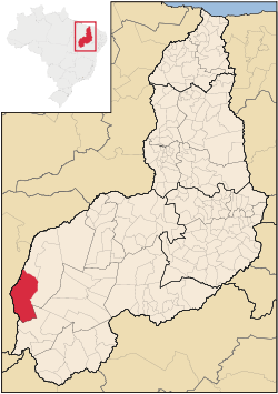 Location in Piauí and Brazil | |
| Coordinates: 09°06′43″S 45°55′19″W / 9.11194°S 45.92194°WCoordinates: 09°06′43″S 45°55′19″W / 9.11194°S 45.92194°W | |
| Country | Brazil |
| Region | Northeast |
| State | Piauí |
| Settled | 1938 |
| Government | |
| • Mayor | Ernani de Paiva Maia (PSDB) |
| Area | |
| • Total | 5,285.447 km2 (2,040.722 sq mi) |
| Population (2008) | |
| • Total | 6,171 |
| • Density | 1.2/km2 (3/sq mi) |
| [1] | |
| Time zone | UTC-3 (UTC-3) |
| • Summer (DST) | UTC-2 (UTC-2) |
| HDI (2000) | 0.618 – medium[2] |
Cristalândia do Piauí is the westernmost city in the Brazilian state of Piauí. The city lies near the Parnaíba River, which forms the border with the state of Maranhão.