Santa Cruz del Quiché
| Santa Cruz del Quiché | |
|---|---|
| Municipality | |
|
Santa Cruz del Quiché, 2007 | |
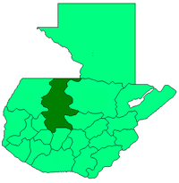
 Santa Cruz del Quiché Location in Guatemala | |
| Coordinates: 15°1′48″N 91°9′0″W / 15.03000°N 91.15000°WCoordinates: 15°1′48″N 91°9′0″W / 15.03000°N 91.15000°W | |
| Country |
|
| Department |
|
| Municipality | Santa Cruz del Quiché |
| Government | |
| • Type | Municipal |
| Area | |
| • Municipality | 311 km2 (120 sq mi) |
| Elevation | 2,021 m (6,631 ft) |
| Highest elevation | 2,500 m (8,200 ft) |
| Lowest elevation | 1,500 m (4,900 ft) |
| Population (Census 2002)[1] | |
| • Municipality | 62,369 |
| • Urban | 20,870 |
| • Ethnicities | K'iche', Ladino |
| • Religions | Roman Catholicism, Evangelicalism, Maya |
| Climate | Cwb |
| Website | http://www.inforpressca.com/quiche/ |

Santa Cruz del Quiché is a city in Guatemala. It serves as the capital of El Quiché department and the municipal seat of Santa Cruz del Quiché municipality.
The city is located at 15°02′N 91°09′W / 15.03°N 91.15°W, at an elevation of 2,021 m (6,631 feet) above sea level. The urban population was about 21,000 people in 2003.
History
Santa Cruz del Quiché was founded by Pedro de Alvarado, a companion and second in-command of conquistador Hernán Cortés, after he burned down the nearby Maya capital city of Q'umarkaj (or Utatlán, in the Nahuatl language). The oldest buildings, including a large cathedral and clock tower in the central plaza, were constructed out of the stones of the Q'umarkaj ruins by the Dominicans. Some think it likely that it was in Santa Cruz where a group of anonymous K'iche' nobles of the Nim Ch'okoj class transcribed the Popol Vuh, the sacred text of the Maya.
In Santa Cruz, the former rulers of Q'umarkaj were reduced to the status of peasant. It is, however, the diocesan seat and as the country was pacified and the distinct native groups were assigned to different municipios and encomendados under the Spanish Colonial system, Europeans lived there, thus Sta. Cruz Quiché became a "ladino" town, where the mestizo traders and Church activities centered.[2] In the 20th Century, the Pan-American Highway passed Santa Cruz by, making it less a gateway to the Western Highlands and only the main stop on the road to the North of el Quiché. As the living conditions for the Indigenous people were so pitiful in the city, the town of Santo Tomás Chichicastenango, about 20 miles to the south of Santa Cruz, began to swell with the immigration of displaced Mayas and soon passed up Santa Cruz in both size and importance.
During the "Civil Wars" from 1956 through 1986, the Army Base outside the city was a major staging point for military control of the lands to the north, which were presumed under guerrilla control as they had been a hotbed for both the CUC, the campesino union, and liberation theology. Many of the Vietnam-era tactics used during the intense fighting from 1977-1984 were launched from there, including the control of the Ixil Triangle, the settlements of "model villages" outside of Nebaj and other major violence.[3]
Santa Cruz del Quiché has an airport.
References
- ↑ "XI Censo Nacional de Poblacion y VI de Habitación (Censo 2002)". INE. 2002.
- ↑ El Maya en la Guatemala de la Colonia
- ↑ author's interview with Col. Matta 10/1985
External links
- Santa Cruz del Quiché - Sistema de Información Municipal
- INE - XI Censo Nacional de Poblacion y VI de Habitación (Censo 2002)
| |||||||||||||