Santa Cruz, Marinduque
| Santa Cruz | ||
|---|---|---|
| Municipality | ||
| ||
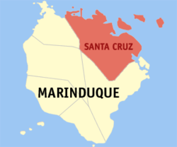 Map of Marinduque showing the location of Santa Cruz | ||
.svg.png) Santa Cruz Location within the Philippines | ||
| Coordinates: 13°28′36″N 122°01′36″E / 13.47667°N 122.02667°ECoordinates: 13°28′36″N 122°01′36″E / 13.47667°N 122.02667°E | ||
| Country |
| |
| Region | MIMAROPA | |
| Province | Marinduque | |
| District | Lone district of Marinduque | |
| Founded | 1609 | |
| Barangays | 55 | |
| Government | ||
| • Mayor | Wilfredo "W" Red ((Liberal)) | |
| • Vice Mayor | Ishmael Lim (Liberal) | |
| • Sangguniang Bayan |
Councilors
| |
| Area[1] | ||
| • Total | 270.77 km2 (104.54 sq mi) | |
| Population (2010)[2] | ||
| • Total | 55,673 | |
| • Density | 210/km2 (530/sq mi) | |
| Demonym | Santa Cruzin | |
| Time zone | PST (UTC+8) | |
| ZIP code | 4902 | |
| Dialing code | 42 | |
| Income class | 1st class; partially urban | |

Santa Cruz is a first class municipality in the province of Marinduque, Philippines. According to the 2010 census, it had a population of 55,673 people.[2]
Barangays
Santa Cruz is politically subdivided into 55 barangays.[1] In 1957 the sitio of Kalangkang, barrio of Kasily, was converted into a barrio.[3]
- Alobo
- Angas
- Aturan
- Bagong Silang Pob. (2nd Zone)
- Baguidbirin
- Baliis
- Balogo
- Banahaw Pob. (3rd Zone Pob.)
- Bangcuangan
- Banogbog
- Biga
- Botilao
- Buyabod
- Dating Bayan
- Devilla
- Dolores
- Haguimit
- Hupi
- Ipil
- Jolo
- Kaganhao
- Kalangkang
- Kamandugan
- Kasily
- Kilo-kilo
- Kinyaman
- Labo
- Lamesa
- Landy(Perez)
- Lapu-lapu Pob. (5th Zone)
- Libjo
- Lipa
- Lusok
- Maharlika Pob. (1st Zone)
- Makulapnit
- Maniwaya
- Manlibunan
- Masaguisi
- Masalukot
- Matalaba
- Mongpong
- Morales
- Napo (Malabon)
- Pag-Asa Pob. (4th Zone)
- Pantayin
- Polo
- Pulong-Parang
- Punong
- San Antonio
- San Isidro
- Tagum
- Tamayo
- Tambangan
- Tawiran
- Taytay
History
In 1942, Japanese imperial forces entered and occupied the town of Santa Cruz.
In 1945, at the beginning of the Battle of Marinduque, Filipino troops of the 5th Infantry Division of the Philippine Commonwealth Army came to Santa Cruz together with the guerrilla units of the Marinduque Revolutionary Army. Marinduque fought the battles against attacks from the Japanese imperial forces in the Second World War.
Republic Act No. 204, approved May 28, 1948, converted the sitios of Angas of the barrio of Tagum, Biga of the barrio of Alobo, Kamandungan of the barrio of Lusok, Kilokilo of the barrio of San Antonio, and Makulapnit of the barrio of Devilla to regular and independent barrios.[4]
In 1953, the sitio of Baguidbirin was converted into a barrio.[5]
Demographics
| Population census of Santa Cruz | ||
|---|---|---|
| Year | Pop. | ±% p.a. |
| 1990 | 52,926 | — |
| 1995 | 56,991 | +1.40% |
| 2000 | 60,055 | +1.13% |
| 2007 | 61,322 | +0.29% |
| 2010 | 55,673 | −3.46% |
| Source: National Statistics Office[2][6] | ||
Transportation
Access to the municipality:
- Via sea - Buyabod Port (ferry coming from Lucena, ro/ro and fastcrafts)
- Via air - Marinduque Airport (Zest Air) - Jeepney to Sta. Cruz via Boac
Twin towns/cities
-
 Valenzuela City, Philippines (2008)
References
- ↑ 1.0 1.1 "Province: MARINDUQUE". PSGC Interactive. Makati City, Philippines: National Statistical Coordination Board. Retrieved 26 July 2013.
- ↑ 2.0 2.1 2.2 "Total Population by Province, City, Municipality and Barangay: as of May 1, 2010". 2010 Census of Population and Housing. National Statistics Office. Retrieved 2012-10-24.
- ↑ "An Act Converting the Sitio of Kalangkang, Barrio of Kasily, Municipality of Sta. Cruz, Province of Marinduque, into a Barrio to Be Known As the Barrio of Kalangkang of Said Municipality". LawPH.com. Retrieved 2011-04-12.
- ↑ "An act converting the sitios of Angas, Biga, Kamandungan, Kilokilo and Makulapnit of the municipality of Santa Cruz, province of Marinduque, into independent barrios". LawPH.com. Retrieved 2011-04-08.
- ↑ "An Act Creating the Barrio of Baguidbirin in the Municipality of Sta. Cruz, Province of Marinduque". LawPH.com. Retrieved 2011-04-09.
- ↑ "Province of Marinduque". Municipality Population Data. LWUA Research Division. Retrieved 25 July 2013.
External links
- Philippine Standard Geographic Code
- Philippine Census Information
- Local Governance Performance Management System
 |
Tayabas Bay | Mongpong Pass / Catanauan, Quezon | | |
| Mogpog | |
Mongpong Pass | ||
| ||||
| | ||||
| Boac | Torrijos |
| ||||||||||