Sant Julià de Lòria
| Sant Julià de Lòria | ||
|---|---|---|
|
Bust of Francesc Cairat near the street in Sant Julià de Lòria | ||
| ||
 Position of Sant Julià de Lòria parish in Andorra | ||
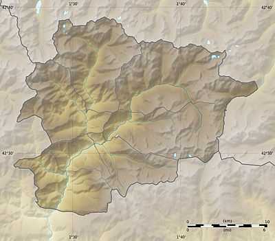 Sant Julià de Lòria Location of Sant Julià de Lòria town within Andorra | ||
| Coordinates (Sant Julià de Lòria town): 42°27′54″N 1°29′28″E / 42.46500°N 1.49111°ECoordinates: 42°27′54″N 1°29′28″E / 42.46500°N 1.49111°E | ||
| Country | Andorra | |
| Parishes | Sant Julià de Lòria | |
| Villages | Aixàs, Aixirivall, Aixovall, Auvinyà, Bixessarri, Canolich, Certers, Fontaneda, Juberri, Llumeneres, Nagol | |
| Government | ||
| • Mayor | Josep Pintat Forné | |
| Area | ||
| • Total | 61 km2 (24 sq mi) | |
| Elevation | 908 m (2,979 ft) | |
| Population (2005) | ||
| • Total | 9,207 | |
| • Density | 150.93/km2 (390.9/sq mi) | |
| Demonym | lauredià, laurediana | |
| Website | Official site | |


Sant Julià de Lòria (Catalan pronunciation: [ˈsaɲ ʒuɫiˈa ðə ˈɫɔɾiə], locally: [ˈsaɲ ʒuliˈa ðe ˈlɔɾia]) is one of the parishes of Andorra, in the far south of that country. It is also the name of the main town of the parish, which at 908 m is the lowest settlement in Andorra. Other settlements in the parish include Bixessarri, Aixàs, Aixovall, Certers, Llumeneres, Nagol, Aixirivall, Auvinyà, Juberri, Fontaneda, and Canòlic.
Education
- University of Andorra
- Naturlandia - Tobotronc
- Festa Major de Sant Julià
- Museu del Tabac
The Escuela Española de Sant Julià de Lòria, a Spanish international primary school, serves the community.[1]
References
External links
![]() Media related to Sant Julià de Lòria at Wikimedia Commons
Media related to Sant Julià de Lòria at Wikimedia Commons