Sant'Antonio di Gallura
| Sant'Antonio di Gallura | |
|---|---|
| Comune | |
| Comune di Sant'Antonio di Gallura | |
 | |
 Sant'Antonio di Gallura Location of Sant'Antonio di Gallura in Italy | |
| Coordinates: 41°0′N 9°18′E / 41.000°N 9.300°ECoordinates: 41°0′N 9°18′E / 41.000°N 9.300°E | |
| Country | Italy |
| Region | Sardinia |
| Province | Province of Olbia-Tempio (OT) |
| Government | |
| • Mayor | Angelo Pitorru |
| Area | |
| • Total | 81.2 km2 (31.4 sq mi) |
| Elevation | 354 m (1,161 ft) |
| Population (31 December 2010)[1] | |
| • Total | 1,692 |
| • Density | 21/km2 (54/sq mi) |
| Demonym | Santantoniesi |
| Time zone | CET (UTC+1) |
| • Summer (DST) | CEST (UTC+2) |
| Postal code | 07030 |
| Dialing code | 079 |
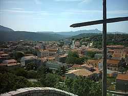
Sant'Antonio di Gallura (Gallurese: Sant' Antòni, Sardinian: Sant' Antòni de Calanzànos) is a municipality in the Province of Olbia-Tempio in the Italian region Sardinia, located about 200 kilometres (120 mi) north of Cagliari and about 20 kilometres (12 mi) northwest of Olbia. Sant'Antonio di Gallura borders the following municipalities: Arzachena, Calangianus, Luras, Olbia, Telti.
The economy is based on agriculture, animal husbandry and production of cork. People move seasonally to the nearby Arzachena and Olbia to work in touristic structures.
Demographic evolution

References
| Wikimedia Commons has media related to Sant'Antonio di Gallura. |