Sant'Angelo a Fasanella
| Sant'Angelo a Fasanella | |
|---|---|
| Comune | |
| Comune di Sant'Angelo a Fasanella | |
|
Panoramic view | |
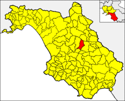 Sant'Angelo a Fasanella within the Province of Salerno and Campania | |
 Sant'Angelo a Fasanella Location of Sant'Angelo a Fasanella in Italy | |
| Coordinates: 40°27′N 15°21′E / 40.450°N 15.350°ECoordinates: 40°27′N 15°21′E / 40.450°N 15.350°E | |
| Country | Italy |
| Region | Campania |
| Province | Salerno (SA) |
| Area | |
| • Total | 32 km2 (12 sq mi) |
| Elevation | 515 m (1,690 ft) |
| Population (2010) | |
| • Total | 717 |
| • Density | 22/km2 (58/sq mi) |
| Demonym | Santangiolesi |
| Time zone | CET (UTC+1) |
| • Summer (DST) | CEST (UTC+2) |
| Postal code | 84027 |
| Dialing code | 0828 |
| Patron saint | Michael the Archangel |
| Saint day | 29 September |
| Website | Official website |
.jpg)
Sant'Angelo a Fasanella is a town and comune in the province of Salerno in the Campania region of south-western Italy. In 2010 its population was 717.[1]
Geography
The town is located in the north-east of Cilento, close to the mountain range of the Alburni. Its municipal territory is bordered by Bellosguardo, Corleto Monforte, Ottati, Petina and Roscigno.
Demographics

References
External links
![]() Media related to Sant'Angelo a Fasanella at Wikimedia Commons
Media related to Sant'Angelo a Fasanella at Wikimedia Commons
- (Italian) Sant'Angelo a Fasanella official website