Sankt Peter am Hart
| Sankt Peter am Hart | ||
|---|---|---|
|
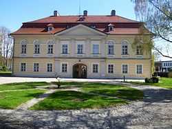
Bogenhofen palace | ||
| ||
 Sankt Peter am Hart Location within Austria | ||
| Coordinates: 48°15′15″N 13°05′40″E / 48.25417°N 13.09444°ECoordinates: 48°15′15″N 13°05′40″E / 48.25417°N 13.09444°E | ||
| Country | Austria | |
| State | Upper Austria | |
| District | Braunau am Inn | |
| Government | ||
| • Mayor | Rüdiger Buchholz (SPÖ) | |
| Area | ||
| • Total | 23 km2 (9 sq mi) | |
| Elevation | 372 m (1,220 ft) | |
| Population (1 January 2014)[1] | ||
| • Total | 2,414 | |
| • Density | 100/km2 (270/sq mi) | |
| Time zone | CET (UTC+1) | |
| • Summer (DST) | CEST (UTC+2) | |
| Postal code | 4963 | |
| Area code | 07722 | |
| Vehicle registration | BR | |
| Website | www.st-peter-hart.ooe.gv.at | |

Sankt Peter am Hart is a municipality in the district of Braunau am Inn in the Austrian state of Upper Austria.
Geography
Sankt Peter lies in the Innviertel. About 15 percent of the municipality is forest and 63 percent farmland.
Localities
- Aching (80)
- Aham (55)
- Aselkam (174)
- Bergham (145)
- Bogenhofen (322)
- Dietfurt (219)
- Guggenberg (9)
- Hagenau (192)
- Hart (18)
- Heitzenberg (25)
- Hundslau (5)
- Jahrsdorf (183)
- Meinharting (8)
- Moos (136)
- Nöfing (106)
- Ofen (87)
- Reikersdorf (270)
- St. Peter am Hart (351)
- Schickenedt (14)
- Spraid (14)
- Wimm (9)
See also
- Oberösterreich
References
| Wikimedia Commons has media related to Sankt Peter am Hart. |