Sankt Pantaleon
| Sankt Pantaleon | ||
|---|---|---|
.JPG) | ||
| ||
 Sankt Pantaleon Location within Austria | ||
| Coordinates: 48°00′26″N 12°53′44″E / 48.00722°N 12.89556°ECoordinates: 48°00′26″N 12°53′44″E / 48.00722°N 12.89556°E | ||
| Country | Austria | |
| State | Upper Austria | |
| District | Braunau am Inn | |
| Government | ||
| • Mayor | Herbert Huber (SPÖ) | |
| Area | ||
| • Total | 18 km2 (7 sq mi) | |
| Elevation | 436 m (1,430 ft) | |
| Population (1 January 2014)[1] | ||
| • Total | 3,112 | |
| • Density | 170/km2 (450/sq mi) | |
| Time zone | CET (UTC+1) | |
| • Summer (DST) | CEST (UTC+2) | |
| Postal code | 5120 | |
| Area code | 06277 | |
| Vehicle registration | BR | |
| Website | www.stpantaleon.at | |

Sankt Pantaleon is a municipality in the district Braunau am Inn in Upper Austria, Austria. A monument was erected by the riverlet Moosach in memory of the slave workers engaged there in 1940/41 at the Weyer concentration camp.
Geography
Sankt Pantaleon lies in the Innviertel. About 24 percent of the municipality is forest and 64 percent farmland.
References
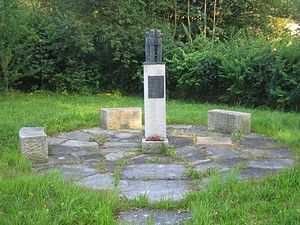
Monument in memory of the victims of the Weyer concentration camp
| Wikimedia Commons has media related to Sankt Pantaleon. |