Sankt Michael im Lungau
| Sankt Michael im Lungau | ||
|---|---|---|
 | ||
| ||
 Sankt Michael im Lungau Location within Austria | ||
| Coordinates: 47°06′00″N 13°38′00″E / 47.10000°N 13.63333°ECoordinates: 47°06′00″N 13°38′00″E / 47.10000°N 13.63333°E | ||
| Country | Austria | |
| State | Salzburg | |
| District | Tamsweg | |
| Government | ||
| • Mayor | Manfred Sampl (ÖVP) | |
| Area | ||
| • Total | 68.80 km2 (26.56 sq mi) | |
| Elevation | 1,075 m (3,527 ft) | |
| Population (1 January 2014)[1] | ||
| • Total | 3,551 | |
| • Density | 52/km2 (130/sq mi) | |
| Time zone | CET (UTC+1) | |
| • Summer (DST) | CEST (UTC+2) | |
| Postal code | 5582 | |
| Area code | 06477 | |
| Vehicle registration | TA | |
| Website | www.sankt-michael.at | |

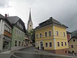
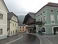
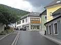
Sankt Michael im Lungau is a market town on the upper Mur River in the Tamsweg district in the Austrian state of Salzburg.
History
The parish church dedicated to Saint Michael was first mentioned in 1147. Together with the historic Lungau region it became a part of the Salzburg archbishopric in the 13th century.
Transport
Sankt Michael has access to the Tauern Autobahn (A 10) and the B99 Katschbergstraße federal highway from the Katschberg Pass and Carinthia to the Radstädter Tauern Pass in the north.
Politics
Seats in the municipal assembly (Gemeinderat) as of 2009 elections:
- 12 Austrian People's Party (ÖVP)
- 7 Social Democratic Party of Austria (SPÖ)
- 2 Freedom Party of Austria (FPÖ)
Twin town
 Bad Leonfelden, Austria
See also
- Salzburgerland
- Salzburg
References
Gallery
-
Sankt Michael im Lungau, view to a street
-
Sankt Michael im Lungau, view to a street
-
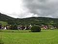
Sankt Martin im Lungau, view to the village
| ||||||