Sanjō, Niigata
| Sanjō 三条市 | ||
|---|---|---|
| City | ||
| ||
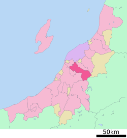 Location of Sanjō in Niigata Prefecture | ||
 Sanjō Location in Japan | ||
| Coordinates: 37°38′N 138°58′E / 37.633°N 138.967°ECoordinates: 37°38′N 138°58′E / 37.633°N 138.967°E | ||
| Country | Japan | |
| Region | Chūbu (Kōshin'etsu) (Hokuriku) | |
| Prefecture | Niigata Prefecture | |
| Government | ||
| • Mayor | Isato Kunisada | |
| Area | ||
| • Total | 431.01 km2 (166.41 sq mi) | |
| Population (March 2006) | ||
| • Total | 107,510 | |
| • Density | 249.43/km2 (646.0/sq mi) | |
| Time zone | Japan Standard Time (UTC+9) | |
| Symbols | ||
| - Tree | Japanese White Pine, Taxus cuspidata | |
| - Flower | Liliaceae, Iris ensata, Sunflower | |
| - Bird | Chicken (Shiba jidori) | |
| Address |
2-3-1 Asahi-chō, Sanjō-shi, Niigata-ken 955-8686 | |
| Phone number | 0256-34-5511 | |
| Website |
www | |

Sanjō (三条市 Sanjō-shi) is a city located in Niigata Prefecture, Japan.
As of March 2006, the city has an estimated population of 107,510, with 33,302 households and a population density of 249.43 persons per km². The total area is 431.01 km².
Geography
Sanjō is located in the center of Niigata Prefecture. It is about 2 hours from Tokyo via the Jōetsu Shinkansen or 4 hours on the Kan-Etsu Expressway and Hokuriku Expressway. The Shinano River flows through the west of it from south to north.
Adjoining municipalities
From the north, following Sanjō's border counterclockwise:
- Niigata
- Tsubame
- Nagaoka
- Mitsuke
- Uonuma
- Tadami, Minamiaizu District, Fukushima
- Aga, Higashikanbara District
- Gosen
- Kamo
Transportation
Rail
The city is served by Tsubame-Sanjō Station on the Jōetsu Shinkansen from Tokyo to Niigata.
History
- 1828
- December 18 - An earthquake struck the town of Sanjō.
- 1889
- 1934
- January 1 - The city of Sanjō was founded.
- 1963
- January - A record-breaking heavy snowfall hits Sanjō.
- 1982
- November 15 - Jōetsu Shinkansen service arrives at Tsubame-Sanjō Station
- 2004
- July 12 & July 13 - Heavy rain causes extensive flooding in Sanjō.
- 2005
- May 1 - The town of Sakae, and the village of Shitada (both from Minamikanbara District) were merged into Sanjō.
Sister cities
-
 Vaughan, Ontario, Canada (since October 18, 1993)
 -
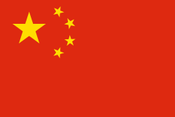 Ezhou, China (since April 28, 1994)
Notable people from Sanjō
- Chihiro Kaneko (baseball player)[1]
- Tetsuji Morohashi (lexicographer)[2]
- Shohei Baba (professional wrestler)
Business headquartered in Sanjō
- Snow Peak (camping manufacture)
See also
References
External links
| Wikimedia Commons has media related to Sanjō, Niigata. |
- Sanjō City official website (Japanese)
- Sanjō City official website (English)
| |||||||||||||||||||||