Sangrampur, Maharashtra
| Sangrampur संग्रामपुर | |
|---|---|
| Town | |
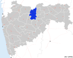
 Sangrampur Location in Maharashtra, India | |
| Coordinates: 21°02′N 76°41′E / 21.03°N 76.68°ECoordinates: 21°02′N 76°41′E / 21.03°N 76.68°E | |
| Country |
|
| State | Maharashtra |
| District | Buldhana |
| Elevation | 273 m (896 ft) |
| Languages | |
| • Official | Marathi |
| Time zone | IST (UTC+5:30) |
| PIN | 444202 |
| Vehicle registration | MH-28 |
Sangrampur is a small town, a tehsil of Buldhana district, Maharashtra State, India.
Geography
It is located in the Buldhana district of the Amravati division of the Vidarbha region of the Maharashtra state in India.[1]
It borders the Jalgaon Jamod tehsil to the north, the Shegaon tehsil of the Buldhana District to the south, the Telhara tehsil of the Akola District to the east and the Burhanpur District of the Madhya Pradesh State to the north.
It has an average elevation of 273 metres (898 feet).
The Maharashtra State Highways 173, 194 and 195 pass through the tehsil and connect to the following:
- 173 ( Shegaon - Warwat Bakal - Bawanbir - Tunki ), connecting Khamgaon on National Highway 6 from Shegaon.
- 194 ( Khandvi - Jalgaon Jamod - Tunki - Sonala - Akot - Daryapur - Nandgaon), connecting National Highway 6 at both ends at Nandura on Khandvi side and at Nadgaon
- 195 ( Jalgaon Jamod - Sangrampur - Warwat Bakal - Telhara - Warula) connecting MH SH 194 and MH SH 24.[2]
The town post office Postal Index Number ( PIN code) is 444202 and PIN is shared with Palsi Zasi, Kakanwada, Warwat Bakal post offices.[3]
Demographics
As of 2001 India census,[4] Sangrampur had a population of 6,506.
Sangrampur Tehsil
Sangrampur tehsil is part of the Jalgaon Jamod Sub-Division for Revenue of the Buldhana district, along with the Jalgaon Jamod Tehsil.
The tehsil has an area of 594 km2 and consists of 105 villages, totaling a population of around 97,000[5]
Some of these villages and their population are
1-Chunkhedi 236, 2-Mohokot 109 3-Anyar 14 4-Mangeri 33 5-Ambabarwa 445, 6-Rohin Khindki 848, 7-Salwan 200, 8-Kamod 29 9-Pingli Kh. 621 10-Pingli Bk. 477 11-Saykhed 1875, 12-Alewadi 2314, 13-Chichari 1174, 14-Wasali 2573, 15-Hadiya Mahal 487 16-Shivani 1141, 17-Karmoda 788, 18-Shewaga Kh. 187 19-Malthana Bk. 244 20-Shewaga Bk 169, 21-Marod 576, 22-Lohagaon Bk. 381 23-Ladnapur 1946, 24-Tunki Kh. 476 25-Panchala Pr.jamod 223 26-Panchala Pr.Bawanbir 226 27-Tunki Bk. 4625, 28-Sonala 11626, 29-Borkhed 278, 30-Sangrampur Pr.sonala 184 31-Warkhed 84, 32-Sagoda 1987, 33-Danapur 104 34-Balhadi 56, 35-Khalad Bk. 143, 36-Palsoda 1236, 37-Bawanbir 5898, 38-Umara 782, 39-Zasi 555 40-Nimkhed 362 41-Sawala or Sawali 577, 42-Dhamangaon 1019 43-Palshi Zasi 3141, 44-Warwat Bakal 4976, 45-Banoda Eklara 2903, 46-Kakanwada Bk. 1462, 47-Kated 890, 48-Wadgaon Pr Adgaon 1305, 49-Kolad 1216, 50-Kakanwada Khurd. 1010, 51-Mominabad 449, 52-Pimpari Adgaon 1400, 53-Rajpur 157 54-Akoli Bk. 910 55-Akoli Kh. 251 56-Changefal Bk. 665 57-Changefal Kh. 707 58-Niwana 1487, 59-Sangrampur Pr.jamod 6506, 60-Tamgaon 1124, 61-Pimpri Kathargaon 566 62-Bodkha 1363, 63-Nirod 989 64-Bhilkhed 713 65-Wakana 1420, 66-Rudhana 2072, 67-Chondhi 622 68-Kakoda 669, 69-Ukadgaon 353 70-Manardi 719 71-Pimpri Kavthal 461 72-Ringanwadi 570 73-Durgadiatya 1016, 74-Wankhed 5378, 75-Takleshwar 501 76-Kalamkhed 712 77-Jastgaon 795, 78-Neknapur 358, 79-Awar 955, 80-Ukali Bk. 1216 81-Kodri 1225, 82-Paturda Khurd 1564, 83-Khel Thorat Paturda 2054, 84-Warwat Khanderao 1447, 85-Hingana Kavthal 360 86-Kumbarkhed 230 87-Kavthal 2673, 88-Itkhed 218 89-Pesoda 1185, 90-Bhon 1149, 91-Sawali 659, 92-Khiroda 1073, 93-Khel Dalavi Paturda 1803, 94-Khel Bhogal Paturda 2346 95-Deulgaon 235, 96-Khel Mali Paturda 1981, 97-Takali Panchgavhan 503 98-Kundhegaon 275, 99-Aswand 350,. Nimkhed, Salabad, Kalamkhed?[6][7]
Agriculture is the main occupation within the tehsil and Sangrampur has an Agricultural Produce Market Committee (APMC) (Krishi Utpann Bajar samiti), with a subcommittee at Paturda, Warwat Bakal and Sonala.[8]
References
- ↑ Falling Rain Genomics, Inc - Sangrampur
- ↑ Sangrampur Taluka
- ↑ Pin codes of Buldhana district, Buldhana pincodes, Maharashtra zip code
- ↑ "Census of India 2001: Data from the 2001 Census, including cities, villages and towns (Provisional)". Census Commission of India. Archived from the original on 2004-06-16. Retrieved 2008-11-01.
- ↑ Buldhana District Disaster Plan, Relief & Rehabilitation Division, Revenue and Forest Department, Government of Maharashtra
- ↑ http://buldhana.nic.in/htmldocs/Attachment/Sangrampur.htm
- ↑ http://projectcare.nic.in/directory/adminreps/viewpansum.asp?selstate=4349&parenttype=B&ptype=V&button1=Submit
- ↑ http://agmarknet.nic.in/profile/profile_online/displayformdetails.asp?mkt=1484
 |
Sonala | | ||
| Jalgaon Jamod | |
Telhara | ||
| ||||
| | ||||
| Shegaon |
| ||||||||||||||||||||||||||||||||||||||||||||||||