Sandyston-Walpack Consolidated School District
| Sandyston-Walpack Consolidated | ||||||||||||||||||||||||||||||||||||||||||||||||||||||||||||
|---|---|---|---|---|---|---|---|---|---|---|---|---|---|---|---|---|---|---|---|---|---|---|---|---|---|---|---|---|---|---|---|---|---|---|---|---|---|---|---|---|---|---|---|---|---|---|---|---|---|---|---|---|---|---|---|---|---|---|---|---|
| Type and location | ||||||||||||||||||||||||||||||||||||||||||||||||||||||||||||
| Grades | K-6 | |||||||||||||||||||||||||||||||||||||||||||||||||||||||||||
| Address |
100 Route 560 Layton, NJ 07851 | |||||||||||||||||||||||||||||||||||||||||||||||||||||||||||
| District information | ||||||||||||||||||||||||||||||||||||||||||||||||||||||||||||
| Superintendent | Martin G. Sumpman | |||||||||||||||||||||||||||||||||||||||||||||||||||||||||||
| Business administrator | Carole Kylish | |||||||||||||||||||||||||||||||||||||||||||||||||||||||||||
| Schools | 1 | |||||||||||||||||||||||||||||||||||||||||||||||||||||||||||
| Students and staff | ||||||||||||||||||||||||||||||||||||||||||||||||||||||||||||
| Enrollment | 144 (as of 2011-12)[1] | |||||||||||||||||||||||||||||||||||||||||||||||||||||||||||
| Faculty | 17.6 FTEs | |||||||||||||||||||||||||||||||||||||||||||||||||||||||||||
| Student-teacher ratio | 8.18:1 | |||||||||||||||||||||||||||||||||||||||||||||||||||||||||||
| Other information | ||||||||||||||||||||||||||||||||||||||||||||||||||||||||||||
| District Factor Group | DE | |||||||||||||||||||||||||||||||||||||||||||||||||||||||||||
| Website | http://www.sandystonwalpack.org | |||||||||||||||||||||||||||||||||||||||||||||||||||||||||||
| ||||||||||||||||||||||||||||||||||||||||||||||||||||||||||||
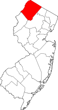
The Sandyston-Walpack Consolidated School District is a consolidated public school district that serves students in Kindergarten through sixth grade from two communities in Sussex County, New Jersey, United States. Students come from Sandyston Township and Walpack Township.[3][4] The school is located in Layton.
As of the 2011-12 school year, the district's one school had an enrollment of 144 students and 17.6 classroom teachers (on an FTE basis), for a student–teacher ratio of 8.18:1.[1]
The district is classified by the New Jersey Department of Education as being in District Factor Group "DE", the fifth-highest of eight groupings. District Factor Groups organize districts statewide to allow comparison by common socioeconomic characteristics of the local districts. From lowest socioeconomic status to highest, the categories are A, B, CD, DE, FG, GH, I and J.[5]
Public school students of middle and high school age in seventh through twelfth grades attend Kittatinny Regional High School, which also serves students from Fredon Township, Hampton Township and Stillwater Township.[4][6] The high school is located in Hampton, about seven minutes outside of the county seat of Newton.
School
- Sandyston Walpack Consolidated School had an enrollment of 144 students as of the 2011-12 school year.[7]
Administration
Core members of the district's administration are:[8][9]
- Martin G. Sumpman, Superintendent
- Carole Kylish, Business Administrator / Board Secretary
References
- ↑ 1.0 1.1 District information for Sandyston-Walpack Township School District, National Center for Education Statistics. Accessed December 8, 2014.
- ↑ Taxpayers' Guide to Education Spending April 2013, New Jersey Department of Education. Accessed April 15, 2013.
- ↑ Sandyston-Walpack School District 2014 Report Card Narrative, New Jersey Department of Education. Accessed March 22, 2015. "Sandyston-Walpack School district spans 50 square miles and encompasses a vast amount of public land including parts of the Delaware Water Gap National Recreation Area, Stokes State Forest and New Jersey Fish and Game lands."
- ↑ 4.0 4.1 About Us, andyston-Walpack Consolidated School. Accessed December 8, 2014. "The elementary students who live in the townships of Sandyston and Walpack attend here. The students of middle and high school age attend Kittatinny Regional High School located in Hampton Township."
- ↑ NJ Department of Education District Factor Groups (DFG) for School Districts, New Jersey Department of Education. Accessed December 8, 2014.
- ↑ Kittatiny Regional School District 2014 Report Card Narrative, New Jersey Department of Education. Accessed March 22, 2015. "Located in beautiful, rural Sussex County in northwest New Jersey, Kittatinny Regional School District serves the five municipalities of Fredon Township, Hampton Township, Sandyston Township, Stillwater Township and the Township of Walpack. The District is comprised of 125 square miles and has a school population of approximately 1200 students."
- ↑ School Data for Sandyston-Walpack Consolidated School, National Center for Education Statistics. Accessed December 8, 2014.
- ↑ Staff, Sandyston-Walpack Consolidated School District. Accessed March 23, 2015.
- ↑ New Jersey School Directory for Sussex County, New Jersey Department of Education. Accessed March 23, 2015.
External links
- Sandyston-Walpack Consolidated School
- Sandyston-Walpack Consolidated School's 2012–13 School Report Card from the New Jersey Department of Education
- Data for Sandyston-Walpack Consolidated School, National Center for Education Statistics
Coordinates: 41°12′55″N 74°49′13″W / 41.215158°N 74.8202°W
| |||||||||||||||||||||||||||||