Sand Creek Township, Decatur County, Indiana
| Sand Creek Township | |
|---|---|
| Township | |
|
The Westport Covered Bridge spans Sand Creek in the township | |
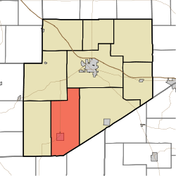 Location of Sand Creek Township in Decatur County | |
| Coordinates: 39°12′24″N 85°33′11″W / 39.20667°N 85.55306°WCoordinates: 39°12′24″N 85°33′11″W / 39.20667°N 85.55306°W | |
| Country | United States |
| State | Indiana |
| County | Decatur |
| Government | |
| • Type | Indiana township |
| Area | |
| • Total | 43.21 sq mi (111.9 km2) |
| • Land | 43.17 sq mi (111.8 km2) |
| • Water | 0.04 sq mi (0.1 km2) |
| Elevation[1] | 856 ft (261 m) |
| Population (2010) | |
| • Total | 3,120 |
| • Density | 72.3/sq mi (27.9/km2) |
| FIPS code | 18-67734[2] |
| GNIS feature ID | 453832 |

Sand Creek Township is one of nine townships in Decatur County, Indiana. As of the 2010 census, its population was 3,120 and it contained 1,331 housing units.[3]
History
Sand Creek Township was organized in 1825.[4]
Geography
According to the 2010 census, the township has a total area of 43.21 square miles (111.9 km2), of which 43.17 square miles (111.8 km2) (or 99.91%) is land and 0.04 square miles (0.10 km2) (or 0.09%) is water.[3]
Cities and towns
Unincorporated towns
- Gaynorsville
- Harper
- Harris City
- Letts
- Letts Corner
- Mapleton Corner
- Neff Corner
- Pinhook
(This list is based on USGS data and may include former settlements.)
Adjacent townships
- Washington Township (northeast)
- Marion Township (east)
- Columbia Township, Jennings County (southeast)
- Sand Creek Township, Jennings County (south)
- Jackson Township (west)
- Clay Township (northwest)
Major highways
Cemeteries
The township contains six cemeteries: Eddleman, Finley, Horseshoe Bend, Mapleton, Rodney and Westport.
References
- ↑ "US Board on Geographic Names". United States Geological Survey. 2007-10-25. Retrieved 2008-01-31.
- ↑ "American FactFinder". United States Census Bureau. Retrieved 2008-01-31.
- ↑ 3.0 3.1 "Population, Housing Units, Area, and Density: 2010 - County -- County Subdivision and Place -- 2010 Census Summary File 1". United States Census. Retrieved 2013-05-10.
- ↑ Harding, Lewis Albert (1915). History of Decatur County, Indiana: Its People, Industries and Institutions. B.F. Bowen. p. 95.
External links
| |||||||||||||||||||||||||||||||||||||