San Quintin, Pangasinan
| San Quintin | ||
|---|---|---|
| Municipality | ||
 | ||
| ||
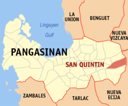 Map of Pangasinan showing the location of San Quintin | ||
.svg.png) San Quintin Location within the Philippines | ||
| Coordinates: 15°59′04″N 120°48′54″E / 15.98444°N 120.81500°ECoordinates: 15°59′04″N 120°48′54″E / 15.98444°N 120.81500°E | ||
| Country |
| |
| Region | Ilocos (Region I) | |
| Province | Pangasinan | |
| District | 6th district of Pangasinan | |
| Founded | June 5, 1863 | |
| Barangays | 21 | |
| Government[1] | ||
| • Mayor | Clark Cecil Tiu | |
| Area[2] | ||
| • Total | 115.90 km2 (44.75 sq mi) | |
| Population (2010)[3] | ||
| • Total | 32,626 | |
| • Density | 280/km2 (730/sq mi) | |
| Time zone | PST (UTC+8) | |
| ZIP code | 2444 | |
| Dialing code | 75 | |
| Income class | 3rd class; partially urban | |
| Website | sanquintinpangasinan.gov.ph | |

San Quintin is a third class municipality in the province of Pangasinan, Philippines. According to the 2010 census, it has a population of 32,626 people.[3]
Barangays
San Quintin is politically subdivided into 21 barangays.[2]
- Alac
- Baligayan
- Bantog
- Bolintaguen
- Cabangaran
- Cabalaoangan
- Calomboyan
- Carayacan
- Casantamaria-an
- Gonzalo
- Labuan
- Lagasit
- Lumayao
- Mabini
- Mantacdang
- Nangapugan
- San Pedro
- Ungib
- Poblacion Zone I
- Poblacion Zone II
- Poblacion Zone III
Demographics
| Population census of San Quintin | ||
|---|---|---|
| Year | Pop. | ±% p.a. |
| 1990 | 24,293 | — |
| 1995 | 26,257 | +1.47% |
| 2000 | 28,258 | +1.59% |
| 2007 | 30,556 | +1.08% |
| 2010 | 32,626 | +2.41% |
| Source: National Statistics Office[3][4] | ||

San Quintin Town Hall
References
- ↑ "Municipalities". Quezon City, Philippines: Department of the Interior and Local Government. Retrieved 26 November 2012.
- ↑ 2.0 2.1 "Province: PANGASINAN". PSGC Interactive. Makati City, Philippines: National Statistical Coordination Board. Retrieved 26 November 2012.
- ↑ 3.0 3.1 3.2 "Total Population by Province, City, Municipality and Barangay: as of May 1, 2010". 2010 Census of Population and Housing. National Statistics Office. Retrieved 26 November 2012.
- ↑ "Province of Pangasinan". Municipality Population Data. LWUA Research Division. Retrieved 5 September 2013.
External links
| Wikimedia Commons has media related to San Quintin, Pangasinan. |
- Philippine Standard Geographic Code
- Philippine Census Information
- Local Governance Performance Management System
- San Quintin Pangasinan
 |
Tayug | Natividad | | |
| Santa Maria | |
Carranglan, Nueva Ecija | ||
| ||||
| | ||||
| Umingan |
| ||||||||||||||||||||||