San Quintin, Abra
| San Quintin | |
|---|---|
| Municipality | |
 | |
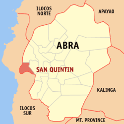 Map of Abra showing the location of San Quintin | |
.svg.png) San Quintin Location within the Philippines | |
| Coordinates: 17°32′35″N 120°31′09″E / 17.54306°N 120.51917°ECoordinates: 17°32′35″N 120°31′09″E / 17.54306°N 120.51917°E | |
| Country | Philippines |
| Region | Cordillera Administrative Region (CAR) |
| Province | Abra |
| District | Lone District of Abra |
| Barangays | 6 |
| Government[1] | |
| • Mayor | Amador B. Diaz |
| Area[2] | |
| • Total | 66.59 km2 (25.71 sq mi) |
| Population (2010)[3] | |
| • Total | 5,233 |
| • Density | 79/km2 (200/sq mi) |
| Time zone | PST (UTC+8) |
| ZIP code | 2808 |
| Dialing code | 74 |
| Income class | 5th class municipality |
San Quintin is a fifth class municipality in the province of Abra, Philippines. According to the 2010 census, it has a population of 5,233 people.[3]
Barangays
San Quintin is politically subdivided into 6 barangays.[2]
| Barangay | Population (2007) |
Population (2010)[3] |
Sitio |
|---|---|---|---|
| Labaan | |
|
4: Vica, Mausoc, Carsuan, Cabaruyan |
| Palang | |
|
1: Talaytay |
| Pantoc | |
|
2: Magmagey, Sabulod |
| Poblacion | |
|
2: Poblacion East, Poblacion West |
| Tangadan | |
|
2: Presentar, Paypayao |
| Villa Mercedes | |
|
2: Purok, Barit-Barit |
Demographics
| Population census of San Quintin | ||
|---|---|---|
| Year | Pop. | ±% p.a. |
| 1990 | 4,293 | — |
| 1995 | 4,999 | +2.89% |
| 2000 | 5,130 | +0.56% |
| 2007 | 5,341 | +0.56% |
| 2010 | 5,233 | −0.74% |
| Source: National Statistics Office[3] | ||
Products
San Quintin's main products are rice, corn, tobacco, mango, freshwater fish etc.
References
- ↑ "Official City/Municipal 2013 Election Results". Intramuros, Manila, Philippines: Commission on Elections (COMELEC). 11 September 2013. Retrieved 30 December 2013.
- ↑ 2.0 2.1 "Province: ABRA". PSGC Interactive. Makati City, Philippines: National Statistical Coordination Board. Retrieved 30 December 2013.
- ↑ 3.0 3.1 3.2 3.3 "Total Population by Province, City, Municipality and Barangay: as of May 1, 2010". 2010 Census of Population and Housing. National Statistics Office. Retrieved 30 December 2013.
External links
 |
Bantay, Ilocos Sur | Langiden | | |
| Santa, Ilocos Sur | |
Pidigan | ||
| ||||
| | ||||
| Narvacan, Ilocos Sur / Nagbukel, Ilocos Sur |
| ||||||||||||||