San Miguel, Surigao del Sur
| San Miguel | |
|---|---|
| Municipality | |
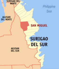 Map of Surigao del Sur with San Miguel highlighted | |
.svg.png) San Miguel Location within the Philippines | |
| Coordinates: 08°53′N 126°00′E / 8.883°N 126.000°ECoordinates: 08°53′N 126°00′E / 8.883°N 126.000°E | |
| Country | Philippines |
| Region | Caraga (Region XIII) |
| Province | Surigao del Sur |
| District | 1st district of Surigao del Sur |
| Barangays | 18 |
| Government[1] | |
| • Mayor | Alvaro S. Elizalde |
| Area[2] | |
| • Total | 558.00 km2 (215.45 sq mi) |
| Population (2010)[3] | |
| • Total | 36,287 |
| • Density | 65/km2 (170/sq mi) |
| Time zone | PST (UTC+8) |
| ZIP code | 8301 |
| Dialing code | 86 |
| Income class | 1st |
San Miguel is a first class municipality in the province of Surigao del Sur, Philippines. According to the 2010 census, it has a population of 36,287 people.[3] With an area of 55,800 hectares (138,000 acres), it is the largest municipality in the province.[2]
Barangays
San Miguel is politically subdivided into 18 barangays.[2]
- Bagyang
- Baras
- Bitaugan
- Bolhoon
- Calatngan
- Carromata
- Castillo
- Libas Gua
- Libas Sud
- Magroyong
- Mahayag (Maitum)
- Patong
- Poblacion
- Sagbayan
- San Roque
- Siagao
- Tina
- Umalag
Demographics
| Population census of San Miguel | ||
|---|---|---|
| Year | Pop. | ±% p.a. |
| 1990 | 21,671 | — |
| 1995 | 24,006 | +1.94% |
| 2000 | 27,883 | +3.26% |
| 2007 | 32,737 | +2.24% |
| 2010 | 36,287 | +3.82% |
| Source: National Statistics Office[3] | ||
References
- ↑ "Official City/Municipal 2013 Election Results". Intramuros, Manila, Philippines: Commission on Elections (COMELEC). 1 July 2013. Retrieved 5 September 2013.
- ↑ 2.0 2.1 2.2 "Province: SURIGAO DEL SUR". PSGC Interactive. Makati City, Philippines: National Statistical Coordination Board. Retrieved 1 April 2014.
- ↑ 3.0 3.1 3.2 "Total Population by Province, City, Municipality and Barangay: as of May 1, 2010". 2010 Census of Population and Housing. National Statistics Office. Retrieved 1 April 2014.
External links
- Philippine Standard Geographic Code
- Philippine Census Information
- Local Governance Performance Management System
 |
Tandag | | ||
| Bayugan, Agusan del Sur | |
Tago | ||
| ||||
| | ||||
| Prosperidad, Agusan del Sur | Marihatag |
| ||||||||||||||