San Marcos de Caiquín
| San Marcos de Caiquín | |
|---|---|
| Municipality | |
|
Arriving in Town | |
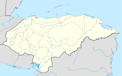 San Marcos de Caiquín Location in Honduras | |
| Coordinates: 14°25′N 88°36′W / 14.417°N 88.600°W | |
| Country | Honduras |
| Department | Lempira |
| Municipality since | 4 November 1994 |
| Area | |
| • Total | 94 km2 (36 sq mi) |
| Population (2001) | |
| • Total | 4,136 |

San Marcos de Caiquín is a municipality in the Honduran department of Lempira; it has the particular significance of being the newest one. In order to make it to the municipality capital, the traveler must start in the city of Gracias.
History
It was created as a municipality on November 4, 1994. The "Lenca" community of San Marcos de Caiquin has historically been a village of La Campa municipality. Its inhabitants are descendants of "Lenca-Chortis" ethnic groups. Because of their cultural and economical activities, they decided to create a municipality with its own ethnic traits.
Geography
It can be said that the municipality capital is located at the toe of the mountain on which San Manuel Colohete is located. To be more precise, it is on a depression among some hills. These hills are covered with pine forests. On the way to this capital, it can be seen on the road the volcanic origin of the rocks and soil.
Boundaries
Its boundaries are:
- North : La Campa municipalities.
- South : Santa Cruz and San Andrés municipalities.
- East : Santa Cruz municipality.
- West : San Manuel Colohete and San Sebastián municipalities.
- Surface area: 94 km²
Resources
The forests provide a profitable economical activity, best of all is that the people have ecological conscience and make the most out them. Coffee plantations are the number one activity, followed by Beans and Corn crops. As the rest of the department, it has electricity and mobile communication services. There are several streams and wells that provide water for the people. At the Mayor's office, many organizations constantly provide training and lectures about improving the well-being and conditions of the locals, since there is a lot to be learned yet.
Population
For San Marcos de Caiquin the descendants of Amerindians are about 80% of population, the rest is represented by the cross-breed of Spanish and Amerindians.
- Population:For the year 2001 the figure was 4,136 ; and in accordance with estimates it is expected to have 4,927 inhabitants for 2008.
- Villages: 7
- Settlements: 54
Tourism
It is about 33 km away, passing by La Campa municipality. 4 km before arriving there is a turn off to San Manuel Colohete, properly indicated to the right. The road after La Campa is not in good shape. The best features are the hills covered with lots of pine forests. If the visitor is looking for quietness, there is no doubt that this place is very good place for that purpose. There are also some small grocery stores.
- Local Holidays: Not available.
External links
| Wikimedia Commons has media related to San Marcos de Caiquín. |
| |||||||||||||
