San Luis, Agusan del Sur
| San Luis | |
|---|---|
| Municipality | |
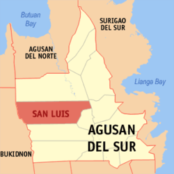 Map of Agusan del Sur with San Luis highlighted | |
.svg.png) San Luis Location within the Philippines | |
| Coordinates: 08°28′41″N 125°44′38″E / 8.47806°N 125.74389°ECoordinates: 08°28′41″N 125°44′38″E / 8.47806°N 125.74389°E | |
| Country | Philippines |
| Region | Caraga (Region XIII) |
| Province | Agusan del Sur |
| District | 1st district of Agusan del Sur |
| Barangays | 25 |
| Government[1] | |
| • Mayor | Ronaldo Y. Corvera |
| Area[2] | |
| • Total | 950.50 km2 (366.99 sq mi) |
| Population (2010)[3] | |
| • Total | 32,733 |
| • Density | 34/km2 (89/sq mi) |
| Time zone | PST (UTC+8) |
| ZIP code | 8511 |
| Dialing code | 85 |
| Income class | 1st |
San Luis is a first class municipality in the province of Agusan del Sur, Philippines. According to the 2010 census, it has a population of 32,733 people.[3] Since the 1970s, the town's economy has been largely based on logging industries.
Barangays
San Luis is politically subdivided into 25 barangays.[2]
- Anislagan
- Baylo
- Coalicion
- Culi
- Nuevo Trabajo
- Poblacion
- Santa Ines
- Balit
- Binicalan
- Cecilia
- Dimasalang
- Don Alejandro
- Don Pedro
- Doña Flavia
- Mahagsay
- Mahapag
- Mahayahay
- Muritula
- Policarpo
- San Isidro
- San Pedro
- Santa Rita
- Santiago
- Wegguam
- Doña Maxima
Demographics
| Population census of San Luis | ||
|---|---|---|
| Year | Pop. | ±% p.a. |
| 1990 | 18,521 | — |
| 1995 | 21,910 | +3.20% |
| 2000 | 25,901 | +3.65% |
| 2007 | 30,424 | +2.24% |
| 2010 | 32,733 | +2.70% |
| Source: National Statistics Office[3] | ||
References
- ↑ "Official City/Municipal 2013 Election Results". Intramuros, Manila, Philippines: Commission on Elections (COMELEC). 1 July 2013. Retrieved 5 September 2013.
- ↑ 2.0 2.1 "Province: AGUSAN DEL SUR". PSGC Interactive. Makati City, Philippines: National Statistical Coordination Board. Retrieved 10 April 2014.
- ↑ 3.0 3.1 3.2 "Total Population by Province, City, Municipality and Barangay: as of May 1, 2010". 2010 Census of Population and Housing. National Statistics Office. Retrieved 10 April 2014.
External links
 |
Esperanza | | ||
| Impasugong, Bukidnon | |
San Francisco | ||
| ||||
| | ||||
| Malaybalay, Bukidnon | La Paz | Talacogon |
| ||||||||||||||