San Jerónimo, Baja Verapaz
| San Jerónimo | |
|---|---|
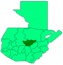
 San Jerónimo Location in Guatemala | |
| Coordinates: 15°03′40″N 90°14′25″W / 15.06111°N 90.24028°W | |
| Country |
|
| Department |
|
| Government | |
| • Mayor | Agustín Cuellar (PP) |
| Climate | Aw |
San Jerónimo (Spanish pronunciation: [saŋ xeˈɾonimo]) is a municipality in the Baja Verapaz department of Guatemala. It is situated at 940 m above sea level. It contains 18,000 people. It covers a terrain of 474 km². The annual festival is September 28-September 30.
The predominant language is Spanish. There is a party and main fair held from 27 to 30 September each year, in honor of the patron Saint Jerome.
History
After the conquest of the Verapaces by the Spanish, the Hacienda de San Jerónimo was created, in the care of Dominican priests, it is believed that friars Luis Cancer, Bartolomé de las Casas, Luis de Ladrada and Pedro Angulo, were the first newcomers to the Valley of San Jerónimo, as Friar Luis Cancer ordered the construction of the Church in the year 1537 and, in the same year in October, took the news to the capital of the Kingdom of Guatemala.
The Hacienda de San Jerónimo was founded between the years 1540 and 1550.
The first sugar plantation in Central America was founded here in 1601 by Rafael Lujan, becoming the most important heritage of the Spanish Kingdom in Central America for its production of sugar, cochineal, grapes, wine and pot liquor (licores de olla).
Friar Francisco Callejos, who was the manager of the Hacienda, constructed a Roman style aqueduct to bring water to the people. The Dominican coat of arms can be found in the ruins of the aqueduct, which still remain. It is located in the town of San Jerónimo, and can be more easily observed along the road to the San Lorenzo farm.
External links
- Muni in Spanish
- http://www.inforpressca.com/sanjeronimo/historia.php
- http://www.arqueotur.org/yacimientos/hacienda-de-san-jeronimo-museo-regional-del-trapiche.html
| ||||||||||||
Coordinates: 15°03′40″N 90°14′25″W / 15.06111°N 90.24028°W