San Isidro, Abra
| San Isidro | |
|---|---|
| Municipality | |
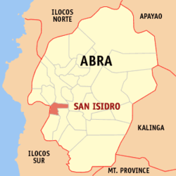 Map of Abra showing the location of San Isidro | |
.svg.png) San Isidro Location within the Philippines | |
| Coordinates: 17°28′N 120°36′E / 17.467°N 120.600°ECoordinates: 17°28′N 120°36′E / 17.467°N 120.600°E | |
| Country | Philippines |
| Region | Cordillera Administrative Region (CAR) |
| Province | Abra |
| District | Lone District of Abra |
| Barangays | 9 |
| Government[1] | |
| • Mayor | Ernesto M. Pacsa Jr. |
| Area[2] | |
| • Total | 48.07 km2 (18.56 sq mi) |
| Population (2010)[3] | |
| • Total | 4,888 |
| • Density | 100/km2 (260/sq mi) |
| Time zone | PST (UTC+8) |
| ZIP code | 2809 |
| Dialing code | 74 |
| Income class | 5th class municipality |
San Isidro is a fifth class municipality in the province of Abra, Philippines. According to the 2010 census, it has a population of 4,888 people.[3]
Barangays
San Isidro is politically subdivided into 9 barangays.[2]
| Barangay | Population (2007) |
Population (2010)[3] |
|---|---|---|
| Cabayogan | |
|
| Dalimag | |
|
| Langbahan | |
|
| Manayday | |
|
| Pantoc | |
|
| Poblacion | |
|
| Sabtan-olo | |
|
| San Marcial | |
|
| Tangbao | |
|
Demographics
| Population census of San Isidro | ||
|---|---|---|
| Year | Pop. | ±% p.a. |
| 1990 | 3,744 | — |
| 1995 | 3,842 | +0.49% |
| 2000 | 4,293 | +2.41% |
| 2007 | 4,647 | +1.10% |
| 2010 | 4,888 | +1.86% |
| Source: National Statistics Office[3] | ||
References
- ↑ "Official City/Municipal 2013 Election Results". Intramuros, Manila, Philippines: Commission on Elections (COMELEC). 11 September 2013. Retrieved 30 December 2013.
- ↑ 2.0 2.1 "Province: ABRA". PSGC Interactive. Makati City, Philippines: National Statistical Coordination Board. Retrieved 30 December 2013.
- ↑ 3.0 3.1 3.2 3.3 "Total Population by Province, City, Municipality and Barangay: as of May 1, 2010". 2010 Census of Population and Housing. National Statistics Office. Retrieved 30 December 2013.
External links
 |
Pidigan | Bangued | | |
| Nagbukel, Ilocos Sur | |
Bucay | ||
| ||||
| | ||||
| Pilar | Villaviciosa |
| ||||||||||||||