San Fernando, La Union
| San Fernando | ||
|---|---|---|
| City | ||
 | ||
| ||
| Nickname(s): The Prime Capital of Ilocandia, Botanical Garden City | ||
 Location in the province of La Union | ||
.svg.png) San Fernando Location within the Philippines | ||
| Coordinates: 16°37′N 120°19′E / 16.617°N 120.317°ECoordinates: 16°37′N 120°19′E / 16.617°N 120.317°E | ||
| Country |
| |
| Region | Ilocos (Region I) | |
| Province | La Union | |
| District | 1st District | |
| Founded | 1850 | |
| Cityhood | 1998 | |
| Barangays | 59 | |
| Government[1] | ||
| • Mayor | Pablo C. Ortega | |
| Area[2] | ||
| • Total | 102.72 km2 (39.66 sq mi) | |
| Population (2010)[3] | ||
| • Total | 114,963 | |
| • Density | 1,100/km2 (2,900/sq mi) | |
| Time zone | PHT (UTC+8) | |
| ZIP code | 2500 | |
| Dialing code | 72 | |
| Income class | 3rd class ; component city | |
| Website |
www | |

San Fernando is a third-class component city and capital of the province of La Union in the Philippines. According to the 2010 Philippine census, it has a population of 114,963 people.[3]
The city is bounded by San Juan to the north, Bauang to the south, Bagulin and Naguilian to the east, and the South China Sea to the west. It has a land area of 10,272 hectares (25,380 acres).[2]
San Fernando is the financial, industrial and political center of the province, as well as the center of the official Ilocos Region, or Region I in the regions of the Philippines. (Informally Ilocos includes those areas that speak the Ilocano language outside of the official Ilocos Region.)
San Fernando became a city by virtue of R.A. 8509 signed into law on February 13, 1998 and ratified on March 20, 1998 by a plebiscite.[4]
History
San Fernando was founded in 1786 and was named after Saint Ferdinand III of Castile. The city's original settlements, San Vicente de Balanac and San Guillermo de Dalangdang, were attacked by pirates and headhunters.
In 1759, Augustinian friar, Padre José Torres fused these 2 settlements to Pindangan (local word for dry fish), where a church dedicated to San Guillermo the Hermit was. This church is now the Cathedral of St. William the Hermit. The massive 1860's earthquake destroyed the church which was later rebuilt.
It became the "cabecera" or provincial capital of La Union province in 1850.
From 1896 until 1898, during the Philippine Revolution, the Spanish garrison of San Fernando was attacked by Filipino insurgents under Manuel Tinio y Bundoc and Mauro Ortiz. The Spaniards were finally ousted.
In the Second World War, the last battle of San Fernando was fought during the Japanese occupation at Barangay Bacsil. The Bacsil Ridge Monument was built on the site in the city, the northwestern portion of the town plaza. The victory ebabled the establishment of the United States Army Base, Base M at Poro Point (a buildup area for the Japan ivasion).[5] The town was liberated in 1945.
In 2010 the police of San Fernando demonstrated the ability to use computer technology when they apprehended suspected serial killer Mark Dizon.[6]
Demographics
| Population census of San Fernando | ||
|---|---|---|
| Year | Pop. | ±% p.a. |
| 1990 | 84,949 | — |
| 1995 | 91,943 | +1.49% |
| 2000 | 102,082 | +2.27% |
| 2007 | 114,813 | +1.63% |
| 2010 | 114,963 | +0.05% |
| Source: National Statistics Office[3][7] | ||
Economy
San Fernando is mainly agricultural (rice, legumes, leafy vegetables, root crops, fruit trees, corn and tobacco). But residents treat fishing in coastline and seashore areas as secondary means of livelihood. The natives also have "inabel" (hand-woven cloth), baskets, shell crafts, including foods, such as "kilawen" and "papaitan", "basi", "sukang iloko" and "paslubong" such as guapples, "longganiza", honey and native rice cakes, "puto", "suman" and "bibingka".
Patopat is San Fernando's native delicacy, made from "agdapil" (sugarcane, a tall tropical Southeast Asian Grass (Saccharum officinarum).
San Fernando has many class A hotels and resorts, night clubs, inter alia.
Local government
The mayor and other elected officers hold office at the city hall of San Fernando. The Sanguniang Bayan is legislature, stationed in the Don Mariano Marcos Building, the Legislative Building in front of the city hall.
Barangays
San Fernando is divided into 59 barangays.[2]
- Abut
- Apaleng
- Bacsil
- Bangbangolan
- Bangcusay
- Barangay I (Pob.)
- Barangay II (Pob.)
- Barangay III (Pob.)
- Barangay IV (Pob.)
- Baraoas
- Bato
- Biday
- Birunget
- Bungro
- Cabaroan (Negro)
- Cabarsican
- Cadaclan
- Calabugao
- Camansi
- Canaoay
- Carlatan
- Catbangen
- Dallangayan Este
- Dallangayan Oeste
- Dalumpinas Este
- Dalumpinas Oeste
- Ilocanos Norte
- Ilocanos Sur
- Langcuas
- Lingsat
- Madayegdeg
- Mameltac
- Masicong
- Nagyubuyuban
- Namtutan
- Narra Este
- Narra Oeste
- Pacpaco
- Pagdalagan
- Pagdaraoan
- Pagudpud
- Pao Norte
- Pao Sur
- Parian
- Pias
- Poro
- Puspus
- Sacyud
- Sagayad
- San Agustin
- San Francisco
- San Vicente
- Santiago Norte
- Santiago Sur
- Saoay
- Sevilla
- Siboan-Otong
- Tanqui
- Tanquigan
List of former chief executives
- 1895-1898 - Blas Tadiar
- 1899-1901 - Paulino Alviar
- 1901-1903 - Gaspar Flores
- 1904-1905 - Edilberto Aquino
- 1906-1907 - Francisco Z. Flores
- 1908-1909 - Urbano Martínez
- 1910-1911 - José Hidalgo
- 1912-1914 - Anastacio Casuga
- 1915-1918 - Juan Salanga
- 1919-1921 - Ulpiano Flores
- 1922-1928 - Pedro R. Flores
- 1928 - Francisco Galvez
- 1928-1930 - Evaristo Galvez
- 1931-1933 - Angel Salanga
- 1934-1936 - Lauro Casuga
- 1936-1939 - Paulino Flores
- 1942-1944 - Juan Salanga
- 1945-1946 - Modesto Aquino
- 1946-1955 - Lorenzo L. Dacanay
- 1956-1959 - Godofredo G. Rilloraza
- 1960-1971 - Lorenzo L. Dacanay
- 1972-1980 - Antonio Feraren
- 1980 - Joaquin T. Ortega
- 1980-1987 - Justo O. Orros Jr.
- 1987 - Rufo T. Colisao
- 1987-1988 - Angel Salanga
- 1988-1998 - Manuel C. Ortega
- 1998-2007 - Mary Jane C. Ortega
- 2007–present - Pablo C. Ortega
Elected officials

Elected officials (June 30, 2010 – 2013):[8]
- Mayor: Pablo C. Ortega
- Vice-Mayor: Hermenegildo A. Gualberto
- Councillors:
- Alfredo Pablo R. Ortega
- Francisco Paolo P. Ortega, V
- Jonathan Justo A. Orros
- Rodolfo M. Abat
- Joseph Bernard D. Valero
- Joseph M. de Guzman
- Andre H. Dacanay
- Florentino G. Flores Jr.
- Marylin R. Jucar
- Lolita G. Dyquiangco
- Ramon F. Laudencia
- Wilfredo P. Ordono
- Ramon C. Ortega, Exec. Vice - President, Liga ng mga Barangay
- Ramon Guio A. Ortega, SK Federation President
Annual community events

The city has a yearly fiesta, celebrated from January 28 to February 15, where a trade fair is opened near the city hall.
The following events happen annually: Annual City Fiesta, February 10; Bacsil Ridge Celebration, March 19; Pindangan Festival, March 20; Ma-tzu Festival, September 16.[9][10]
Tourism
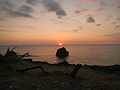
- Poro Point
- Poro Point Special Economic and Freeport Zone (formerly American Military Base – Wallace Air Station)
- Thunderbird Resorts (Philippines)
- The La Union Botanical Garden (8 kilometers from the city) – is a 10 hectare garden (Barngay Cadaclan), the home of various species of rare plants and a sanctuary of wild animals.
- Bacsil Bridge and Monument
- Pindangan Ruins (Barangay Parian)
- Seven Hills
- Moro Watch Tower (Barangay Carlatan)
- La Union Science Centrum & Museum (LUSCM has 5 Galleries: Kadaklan Burial Site and Environmental Gallery, Museum, Dark Room, Main Science Gallery and Portable Planetarium (Barangay Cadaclan)
- Ma-Cho Temple
- Heroes’ Hill (Barangay II, at Poblacion, Provincial Capitol) & Freedom Park Stairway (153 steps)
- Bethany Hill, Mirador Hill, Mariner's Hill, Miracle Hill (Barangay II, Pagoda Hill, Poblacion)
- Tomb of Unknown Soldier (Barangay Madayegdeg)
- Boardwalk
- Cathedral of St. William the Hermit (Barangay II, Poblacion)
- Christ the Redeemer (25 foot statue, Reservoir Hill)
- Kasay Marine Sanctuary: 30 hectares MPA, featuring the 50 years old Giant clam or Tridacna gigas (Barangay Canaoay)
- Children’s Park (Barangay II, City Plaza)
- 10.6 hectares Engineered Sanitary Landfill (Barangay Mameltac)[11]
- La Union Trade Center (beside the City Hall)
Education
San Fernando has 32 public and 55 private schools (academies and colleges or universities): 27 public and 17 private elementary schools, 6 private and 11 public high schools, 11 colleges and universities.
Gallery
-

Downtown
-

Downtown
-

Provincial Capitol of La Union
-

Overview of San Fernando City
-

The Town Park
-

Gate of the Plaza and Auditorium
-
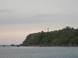
The Lighthouse of Poro Point
-

Pagoda
-
-

Night market

Sister city
-
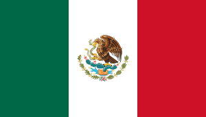 Coatzacoalcos, Mexico
 -
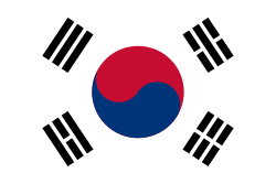 Seoul, South Korea
References
- ↑ "Cities". Quezon City, Philippines: Department of the Interior and Local Government. Retrieved 29 November 2012.
- ↑ 2.0 2.1 2.2 "Province: La Union". PSGC Interactive. Makati City, Philippines: National Statistical Coordination Board. Retrieved 29 November 2012.
- ↑ 3.0 3.1 3.2 "Total Population by Province, City, Municipality and Barangay: as of May 1, 2010" (PDF). 2010 Census of Population and Housing. National Statistics Office. Retrieved 26 November 2012.
- ↑ http://www.sanfernandocity.gov.ph/download/REPUBLIC%20ACT%20No.8509.pdf
- ↑ http://www.localphilippines.com/attractions/1240/battle-of-san-fernando-marker
- ↑ "Facebook Helps Philippines Murder Suspect Investigation and Capture". National Ledger. July 28, 2010. Retrieved July 29, 2010.
- ↑ "Province of La Union". Municipality Population Data. LWUA Research Division. Retrieved 7 August 2013.
- ↑ Joint Oath-Taking and Inauguration of Newly-Elect Officials of the Province of La Union and City of San Fernando
- ↑ http://www.sanfernandocity.gov.ph/news/news185.php
- ↑ http://www.sanfernandocity.gov.ph/news/news187.php
- ↑ http://www.sanfernandocity.gov.ph/services/tourist.php
External links
| Wikimedia Commons has media related to San Fernando City, La Union. |
- The Official Website of San Fernando City
- R.A. 8508 - "Charter of the City of San Fernando."
- Diocese of San Fernando de La Union
- Philippine Standard Geographic Code
- Philippine Census Information
- Local Governance Performance Management System
 |
San Juan | San Gabriel | | |
| South China Sea | |
Bagulin | ||
| ||||
| | ||||
| Bauang | Naguilian |
| ||||||||||||||||||

| ||||||||||||||
| ||||||||||||||||||||||||||||||||||||