San Antonio Palopó
| San Antonio Palopó | |
|---|---|
| Municipality and village | |
 | |
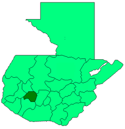
 San Antonio Palopó location of San Antonio Palopó in Guatemala | |
| Coordinates: 14°42′N 91°7′W / 14.700°N 91.117°W | |
| Country |
|
| Department |
|
| Named for | St. Anthony of Padua |
| Government | |
| • Type | Municipal |
| Lowest elevation | 1,562 m (5,125 ft) |
| Time zone | Central Time (UTC-6) |
| Country calling code | 502 |
| Climate | Cwb |
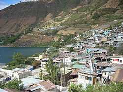
San Antonio Palopó is a municipality in the Sololá department of Guatemala. The village is on the eastern shore of Lake Atitlán. The lowest elevation is 1,562 metres (5,125 ft) at the shoreline. The people of the region are Cakchiquel Maya with a distinctive style of clothing. The patron saint of the village is St. Anthony of Padua. The annual festival takes place on 13 June.[1]
References
- ↑ "San Antonio Palopó" (in Spanish). INGUAT, the Guatemalan Ministry of Tourism.
| Wikimedia Commons has media related to San Antonio Palopó. |