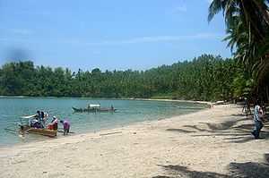
Samar
 Map of the Philippines showing the location of Samar | |
.svg.png) Samar Island (Philippines) | |
| Geography | |
|---|---|
| Location | South East Asia |
| Archipelago | Visayas |
| Area | 13,079 km2 (5,050 sq mi) |
| Area rank | 62nd |
| Country | |
|
Philippines | |
| Province | Samar province, Northern Samar, and Eastern Samar |
| Demographics | |
| Population | 1,783,690 (as of 2010) |
| Density | 138.8 /km2 (359.5 /sq mi) |
Samar (/ˈsɑːmɑr/ SAH-mar) is an island in the Visayas, within central Philippines and considered the third largest island in the country. The island is divided into three provinces: Samar province (the western two-fifths of the island of Samar), Northern Samar province, and Eastern Samar province. These three provinces, along with the provinces on the nearby islands of Leyte and Biliran are part of the Eastern Visayas region.
Samar is the easternmost island in the Visayas. The island is separated from Leyte by the San Juanico Strait, which at its narrowest point is only about two kilometers across. This strait is crossed by the San Juanico Bridge. Samar lies southeast of the Bicol Peninsula on Luzon, the country's largest island; the San Bernardino Strait separates the two. To the south of Samar is the Leyte Gulf, the site of the Battle of Leyte Gulf, one of the most decisive naval battles during the Second World War. The gulf opens out into the Philippine Sea, found to the east of Samar and is part of the Pacific Ocean.
History
Samar was the first island of the Philippines sighted by the Spanish expedition of Ferdinand Magellan on 16 March 1521 after having left the Mariana Islands. Realizing he had arrived at an archipelago he charted the islands as San Lazaro (Saint Lazarus in Spanish) because they were sighted on Lazarus Saturday. Even if Samar was the first island of the Philippines sighted by Magellan, he did not land and continued sailing south till, after anchoring at Suluan Island, he finally landed on Homonhon Island on 17 March 1521.[1]
References
- ↑ Parr, Charles McKew So Noble a Captain: The Life and Times of Ferdinand Magellan Thomas Y. Crowell, New York, 1953. p.431
External links
-
 Media related to Samar (island) at Wikimedia Commons
| ||||||||||||||||||||||||||