Sakahogi, Gifu
| Sakahogi 坂祝町 | ||
|---|---|---|
| Town | ||
| ||
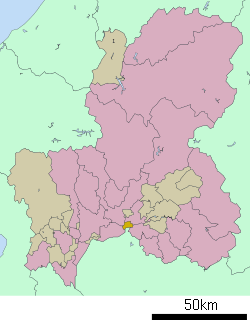 Location of Sakahogi in Gifu Prefecture | ||
 Sakahogi Location in Japan | ||
| Coordinates: 35°26′N 136°59′E / 35.433°N 136.983°ECoordinates: 35°26′N 136°59′E / 35.433°N 136.983°E | ||
| Country | Japan | |
| Region | Chūbu | |
| Prefecture | Gifu Prefecture | |
| District | Kamo | |
| Government | ||
| • Mayor | Muneyuki Minamiyama[1] | |
| Area | ||
| • Total | 12.89 km2 (4.98 sq mi) | |
| Population (July 2011[2]) | ||
| • Total | 8,443 | |
| • Density | 660/km2 (1,700/sq mi) | |
| Time zone | Japan Standard Time (UTC+9) | |
| Symbols | ||
| - Tree | Nandina[3] | |
| - Flower | Salvia[3] | |
| Address |
Torikumi 46-18, Sakahogi-Chō, Kamo-gun, Gifu-ken 505-8501 | |
| Phone number | 0574-26-7111 | |
| Website | Town of Sakahogi | |

Sakahogi (坂祝町 Sakahogi-chō) is a town located in Kamo District, Gifu Prefecture, Japan.
As of July 2011, the town has an estimated population of 8,443. The total area is 12.89 km². The town was formed in 1968.
History
Sakahogi was formed on October 1, 1968 when the village of Sakahogi (坂祝村 Sakahogi-mura) gained town status. The village of Sakahogi was formed on April 1, 1897 by a merger of the villages of Sakakura, Torikumi, Ōhari, Kuroiwa, Fukagaya, Katsuyama and Fukada, and got its name from Sakahogi shrine. In 1950 the Fukada part of Sakahogi was merged into the town of Ōta, now a part of Minokamo.[3]
Education
Transportation
Railroad
- JR Central
Notes
- ↑ 坂祝町のプロフィール > 町長のあいさつ. Sakahogi official website (in Japanese). Retrieved August 12, 2011.
- ↑ 岐阜県の人口・世帯数人口動態統計調査結果. Gifu prefectural website (in Japanese). Gifu Prefecture. Retrieved September 11, 2011.
- ↑ 3.0 3.1 3.2 トップページ(坂祝町のプロフィール) > 町の概要. Sakahogi official website (in Japanese). Retrieved August 12, 2011.
External links
![]() Media related to Sakahogi, Gifu at Wikimedia Commons
Media related to Sakahogi, Gifu at Wikimedia Commons
- Sakahogi official website (Japanese)