Sainte-Agathe-la-Bouteresse
| Sainte-Agathe-la-Bouteresse | ||
|---|---|---|
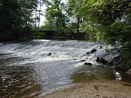
|
A weir on the Lignon du Forez, in Sainte-Agathe-la-Bouteresse | ||
| ||
 Sainte-Agathe-la-Bouteresse | ||
|
Location within Rhône-Alpes region  Sainte-Agathe-la-Bouteresse | ||
| Coordinates: 45°44′06″N 4°03′21″E / 45.735°N 4.0558°ECoordinates: 45°44′06″N 4°03′21″E / 45.735°N 4.0558°E | ||
| Country | France | |
| Region | Rhône-Alpes | |
| Department | Loire | |
| Arrondissement | Montbrison | |
| Canton | Boën-sur-Lignon | |
| Government | ||
| • Mayor | Patrick Verney-Carron | |
| Area1 | 11.75 km2 (4.54 sq mi) | |
| Population (1999)2 | 813 | |
| • Density | 69/km2 (180/sq mi) | |
| INSEE/Postal code | 42197 / 42130 | |
| Elevation |
355–411 m (1,165–1,348 ft) (avg. 387 m or 1,270 ft) | |
|
1 French Land Register data, which excludes lakes, ponds, glaciers > 1 km² (0.386 sq mi or 247 acres) and river estuaries. 2 Population without double counting: residents of multiple communes (e.g., students and military personnel) only counted once. | ||
.svg.png)
Sainte-Agathe-la-Bouteresse is a commune in the Loire department in central France.
Geography
The river Lignon du Forez flows through the commune.
See also
References
| Wikimedia Commons has media related to Sainte-Agathe-la-Bouteresse. |