Saint-Sébastien, Creuse
| Saint-Sébastien | |
|---|---|
|
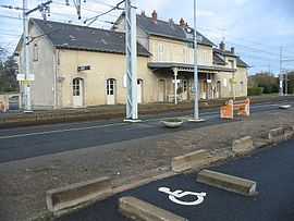
The Saint-Sébastien railway station | |
 Saint-Sébastien | |
|
Location within Limousin region  Saint-Sébastien | |
| Coordinates: 46°23′31″N 1°31′57″E / 46.3919°N 1.5325°ECoordinates: 46°23′31″N 1°31′57″E / 46.3919°N 1.5325°E | |
| Country | France |
| Region | Limousin |
| Department | Creuse |
| Arrondissement | Guéret |
| Canton | Dun-le-Palestel |
| Intercommunality | Pays Dunois |
| Government | |
| • Mayor (2008–2014) | Jean-Claude Carpentier |
| Area1 | 24.98 km2 (9.64 sq mi) |
| Population (2008)2 | 692 |
| • Density | 28/km2 (72/sq mi) |
| INSEE/Postal code | 23239 / 23160 |
| Elevation |
244–361 m (801–1,184 ft) (avg. 321 m or 1,053 ft) |
|
1 French Land Register data, which excludes lakes, ponds, glaciers > 1 km² (0.386 sq mi or 247 acres) and river estuaries. 2 Population without double counting: residents of multiple communes (e.g., students and military personnel) only counted once. | |
Saint-Sébastien is a commune in the Creuse department in central France.
Geography
The village lies in the middle of the commune, above the right bank of the Abloux, which flows north through the commune.
Population
| Historical population | ||
|---|---|---|
| Year | Pop. | ±% |
| 1962 | 1,134 | — |
| 1968 | 1,064 | −6.2% |
| 1975 | 973 | −8.6% |
| 1982 | 854 | −12.2% |
| 1990 | 736 | −13.8% |
| 1999 | 705 | −4.2% |
| 2008 | 692 | −1.8% |
See also
References
| Wikimedia Commons has media related to Saint-Sébastien (Creuse). |