Saint-Quentin-sur-Charente
| Saint-Quentin-sur-Charente | |
|---|---|
|
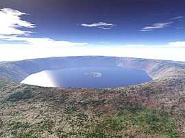
Rochechouart crater shortly after it was formed | |
 Saint-Quentin-sur-Charente | |
|
Location within Poitou-Charentes region  Saint-Quentin-sur-Charente | |
| Coordinates: 45°50′20″N 0°40′16″E / 45.8389°N 0.6711°ECoordinates: 45°50′20″N 0°40′16″E / 45.8389°N 0.6711°E | |
| Country | France |
| Region | Poitou-Charentes |
| Department | Charente |
| Arrondissement | Confolens |
| Canton | Chabanais |
| Intercommunality | Haute-Charente |
| Government | |
| • Mayor (2008–2014) | Alexandre Hamon |
| Area1 | 14.39 km2 (5.56 sq mi) |
| Population (2008)2 | 225 |
| • Density | 16/km2 (40/sq mi) |
| INSEE/Postal code | 16345 / 16150 |
| Elevation |
169–263 m (554–863 ft) (avg. 200 m or 660 ft) |
|
1 French Land Register data, which excludes lakes, ponds, glaciers > 1 km² (0.386 sq mi or 247 acres) and river estuaries. 2 Population without double counting: residents of multiple communes (e.g., students and military personnel) only counted once. | |
Saint-Quentin-sur-Charente is a commune in the Charente department in southwestern France.
Population
| Historical population | ||
|---|---|---|
| Year | Pop. | ±% |
| 1793 | 598 | — |
| 1800 | 510 | −14.7% |
| 1806 | 568 | +11.4% |
| 1821 | 615 | +8.3% |
| 1831 | 535 | −13.0% |
| 1841 | 643 | +20.2% |
| 1846 | 636 | −1.1% |
| 1851 | 640 | +0.6% |
| 1856 | 601 | −6.1% |
| 1861 | 584 | −2.8% |
| 1866 | 579 | −0.9% |
| 1872 | 559 | −3.5% |
| 1876 | 543 | −2.9% |
| 1881 | 571 | +5.2% |
| 1886 | 534 | −6.5% |
| 1891 | 539 | +0.9% |
| 1896 | 525 | −2.6% |
| 1901 | 497 | −5.3% |
| 1906 | 514 | +3.4% |
| 1911 | 516 | +0.4% |
| 1921 | 401 | −22.3% |
| 1926 | 425 | +6.0% |
| 1931 | 382 | −10.1% |
| 1936 | 349 | −8.6% |
| 1946 | 329 | −5.7% |
| 1954 | 337 | +2.4% |
| 1962 | 347 | +3.0% |
| 1968 | 294 | −15.3% |
| 1975 | 250 | −15.0% |
| 1982 | 245 | −2.0% |
| 1990 | 250 | +2.0% |
| 1999 | 232 | −7.2% |
| 2008 | 225 | −3.0% |
See also
References
| Wikimedia Commons has media related to Saint-Quentin-sur-Charente. |