Saint-Pourçain-sur-Sioule
| Saint-Pourçain-sur-Sioule | ||
|---|---|---|
|
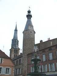
The belfry of the church and the clock tower | ||
| ||
 Saint-Pourçain-sur-Sioule | ||
|
Location within Auvergne region  Saint-Pourçain-sur-Sioule | ||
| Coordinates: 46°18′30″N 3°17′24″E / 46.3083°N 3.29°ECoordinates: 46°18′30″N 3°17′24″E / 46.3083°N 3.29°E | ||
| Country | France | |
| Region | Auvergne | |
| Department | Allier | |
| Arrondissement | Moulins | |
| Canton | Saint-Pourçain-sur-Sioule | |
| Intercommunality | Pays Saint-Pourcinois | |
| Government | ||
| • Mayor (2008–2014) | Bernard Coulon | |
| Area1 | 35.67 km2 (13.77 sq mi) | |
| Population (2008)2 | 5,065 | |
| • Density | 140/km2 (370/sq mi) | |
| INSEE/Postal code | 03254 / 03500 | |
| Elevation |
226–306 m (741–1,004 ft) (avg. 237 m or 778 ft) | |
|
1 French Land Register data, which excludes lakes, ponds, glaciers > 1 km² (0.386 sq mi or 247 acres) and river estuaries. 2 Population without double counting: residents of multiple communes (e.g., students and military personnel) only counted once. | ||

Saint-Pourçain-sur-Sioule is a commune in the Allier department in Auvergne in central France.
Geography
The commune is located 28 km (17 mi) north of Vichy and 32 km (20 mi) south of Moulins on the Route nationale 9.
The river Bouble forms part of the commune's southern border, then flows into the Sioule, which flows north-northeast through the commune and crosses the town.
Population
| Historical population | ||
|---|---|---|
| Year | Pop. | ±% |
| 1793 | 3,458 | — |
| 1800 | 3,395 | −1.8% |
| 1806 | 3,559 | +4.8% |
| 1821 | 3,975 | +11.7% |
| 1831 | 4,376 | +10.1% |
| 1836 | 4,731 | +8.1% |
| 1841 | 4,636 | −2.0% |
| 1846 | 4,961 | +7.0% |
| 1851 | 4,938 | −0.5% |
| 1856 | 4,873 | −1.3% |
| 1861 | 5,006 | +2.7% |
| 1866 | 5,001 | −0.1% |
| 1872 | 4,997 | −0.1% |
| 1876 | 4,998 | +0.0% |
| 1881 | 5,025 | +0.5% |
| 1886 | 5,106 | +1.6% |
| 1891 | 4,998 | −2.1% |
| 1896 | 5,001 | +0.1% |
| 1901 | 4,943 | −1.2% |
| 1906 | 5,101 | +3.2% |
| 1911 | 4,921 | −3.5% |
| 1921 | 4,579 | −6.9% |
| 1926 | 4,810 | +5.0% |
| 1931 | 4,598 | −4.4% |
| 1936 | 4,560 | −0.8% |
| 1946 | 4,430 | −2.9% |
| 1954 | 4,414 | −0.4% |
| 1962 | 4,799 | +8.7% |
| 1968 | 5,088 | +6.0% |
| 1975 | 5,345 | +5.1% |
| 1982 | 5,199 | −2.7% |
| 1990 | 5,159 | −0.8% |
| 1999 | 5,263 | +2.0% |
| 2008 | 5,065 | −3.8% |
Wine
Saint-Pourçain wine is made in an area around the commune.
Personalities
- French diplomat and cryptographer Blaise de Vigenère was born in the town in 1523.
See also
References
External links
| Wikimedia Commons has media related to Saint-Pourçain-sur-Sioule. |
- Official website (French)