Saint-Pierre-des-Échaubrognes
| Saint-Pierre-des-Échaubrognes | |
|---|---|
|
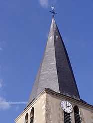
The church tower | |
 Saint-Pierre-des-Échaubrognes | |
|
Location within Poitou-Charentes region  Saint-Pierre-des-Échaubrognes | |
| Coordinates: 46°59′25″N 0°44′35″W / 46.9903°N 0.7431°WCoordinates: 46°59′25″N 0°44′35″W / 46.9903°N 0.7431°W | |
| Country | France |
| Region | Poitou-Charentes |
| Department | Deux-Sèvres |
| Arrondissement | Bressuire |
| Canton | Mauléon |
| Intercommunality | Delta-Sèvre-Argent |
| Government | |
| • Mayor (2008–2014) | Claude Pousin |
| Area1 | 28.92 km2 (11.17 sq mi) |
| Population (2006)2 | 1,403 |
| • Density | 49/km2 (130/sq mi) |
| INSEE/Postal code | 79289 / 79700 |
| Elevation |
102–195 m (335–640 ft) (avg. 137 m or 449 ft) |
|
1 French Land Register data, which excludes lakes, ponds, glaciers > 1 km² (0.386 sq mi or 247 acres) and river estuaries. 2 Population without double counting: residents of multiple communes (e.g., students and military personnel) only counted once. | |
Saint-Pierre-des-Échaubrognes is a commune in the Deux-Sèvres department in western France.
See also
References
| Wikimedia Commons has media related to Saint-Pierre-des-Échaubrognes. |