Saint-Pierre-de-Mésage
| Saint-Pierre-de-Mésage | |
|---|---|
_-_Plaine_de_Vizille.jpg) | |
 Saint-Pierre-de-Mésage | |
|
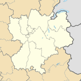
Location within Rhône-Alpes region  Saint-Pierre-de-Mésage | |
| Coordinates: 45°03′14″N 5°45′51″E / 45.0540°N 5.7642°ECoordinates: 45°03′14″N 5°45′51″E / 45.0540°N 5.7642°E | |
| Country | France |
| Region | Rhône-Alpes |
| Department | Isère |
| Arrondissement | Grenoble |
| Canton | Vizille |
| Intercommunality | Sud Grenoblois |
| Government | |
| • Mayor (2014–2020) | Christian Masnada |
| Area1 | 7.03 km2 (2.71 sq mi) |
| Population (2011)2 | 727 |
| • Density | 100/km2 (270/sq mi) |
| INSEE/Postal code | 38445 / 38220 |
| Elevation |
289–1,342 m (948–4,403 ft) (avg. 340 m or 1,120 ft) |
|
1 French Land Register data, which excludes lakes, ponds, glaciers > 1 km² (0.386 sq mi or 247 acres) and river estuaries. 2 Population without double counting: residents of multiple communes (e.g., students and military personnel) only counted once. | |
Saint-Pierre-de-Mésage is a commune in the Isère department in southeastern France.
Saint-Pierre-de-Mésage is located next to the mountain of Connex and between the Vercors and Taillefer. Near Vizille and Grenoble.
In 1946 an accident along the Rampe de Laffrey killed 18 near here.
Population
| Historical population | ||
|---|---|---|
| Year | Pop. | ±% |
| 1793 | 441 | — |
| 1806 | 486 | +10.2% |
| 1821 | 513 | +5.6% |
| 1831 | 593 | +15.6% |
| 1851 | 648 | +9.3% |
| 1851 | 677 | +4.5% |
| 1861 | 671 | −0.9% |
| 1872 | 771 | +14.9% |
| 1881 | 821 | +6.5% |
| 1891 | 702 | −14.5% |
| 1901 | 700 | −0.3% |
| 1911 | 575 | −17.9% |
| 1921 | 433 | −24.7% |
| 1931 | 473 | +9.2% |
| 1946 | 423 | −10.6% |
| 1954 | 462 | +9.2% |
| 1962 | 442 | −4.3% |
| 1968 | 510 | +15.4% |
| 1975 | 508 | −0.4% |
| 1982 | 584 | +15.0% |
| 1990 | 600 | +2.7% |
| 1999 | 674 | +12.3% |
| 2006 | 704 | +4.5% |
| 2011 | 727 | +3.3% |
See also
References
| Wikimedia Commons has media related to Saint-Pierre-de-Mésage. |