Saint-Pantaléon-de-Lapleau
| Saint-Pantaléon-de-Lapleau | ||
|---|---|---|
|
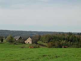
A general view of Saint-Pantaléon-de-Lapleau | ||
| ||
 Saint-Pantaléon-de-Lapleau | ||
|
Location within Limousin region  Saint-Pantaléon-de-Lapleau | ||
| Coordinates: 45°19′26″N 2°12′20″E / 45.3239°N 2.2056°ECoordinates: 45°19′26″N 2°12′20″E / 45.3239°N 2.2056°E | ||
| Country | France | |
| Region | Limousin | |
| Department | Corrèze | |
| Arrondissement | Tulle | |
| Canton | Lapleau | |
| Intercommunality | Gorges de la haute Dordogne | |
| Government | ||
| • Mayor (2008–2014) | Guy Bourgeade | |
| Area1 | 8.46 km2 (3.27 sq mi) | |
| Population (2008)2 | 68 | |
| • Density | 8.0/km2 (21/sq mi) | |
| INSEE/Postal code | 19228 / 19160 | |
| Elevation |
332–609 m (1,089–1,998 ft) (avg. 612 m or 2,008 ft) | |
|
1 French Land Register data, which excludes lakes, ponds, glaciers > 1 km² (0.386 sq mi or 247 acres) and river estuaries. 2 Population without double counting: residents of multiple communes (e.g., students and military personnel) only counted once. | ||
.svg.png)
Saint-Pantaléon-de-Lapleau is a commune in the Corrèze department in central France.
Geography
The Luzège forms part of the commune's southwestern boundary.
Population
| Historical population | ||
|---|---|---|
| Year | Pop. | ±% |
| 1962 | 76 | — |
| 1968 | 106 | +39.5% |
| 1975 | 80 | −24.5% |
| 1982 | 55 | −31.2% |
| 1990 | 65 | +18.2% |
| 1999 | 66 | +1.5% |
| 2008 | 68 | +3.0% |
See also
References
| Wikimedia Commons has media related to Saint-Pantaléon-de-Lapleau. |