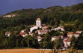
Saint-Pantaléon, Lot
| Saint-Pantaléon | |
|---|---|
 | |
 Saint-Pantaléon | |
|
Location within Midi-Pyrénées region  Saint-Pantaléon | |
| Coordinates: 44°22′09″N 1°16′00″E / 44.3692°N 1.2667°ECoordinates: 44°22′09″N 1°16′00″E / 44.3692°N 1.2667°E | |
| Country | France |
| Region | Midi-Pyrénées |
| Department | Lot |
| Arrondissement | Cahors |
| Canton | Montcuq |
| Intercommunality | Canton of Montcuq |
| Government | |
| • Mayor (2001–2008) | Gérard Lacroix |
| Area1 | 19.37 km2 (7.48 sq mi) |
| Population (1999)2 | 223 |
| • Density | 12/km2 (30/sq mi) |
| INSEE/Postal code | 46285 / 46800 |
| Elevation |
175–305 m (574–1,001 ft) (avg. 193 m or 633 ft) |
|
1 French Land Register data, which excludes lakes, ponds, glaciers > 1 km² (0.386 sq mi or 247 acres) and river estuaries. 2 Population without double counting: residents of multiple communes (e.g., students and military personnel) only counted once. | |
Saint-Pantaléon is a commune in the Lot department in south-western France.
Geography
The village lies in the valley of the ruisseau de Fraysse, a tributary of the Barguelonnette, which flows southwestward through the commune.
See also
References
| Wikimedia Commons has media related to Saint-Pantaléon (Lot). |