Saint-Pal-de-Senouire
| Saint-Pal-de-Senouire | |
|---|---|
|
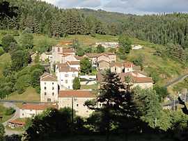
The village of Saint-Pal-de-Senouire | |
 Saint-Pal-de-Senouire | |
|
Location within Auvergne region  Saint-Pal-de-Senouire | |
| Coordinates: 45°15′36″N 3°39′05″E / 45.26°N 3.6514°ECoordinates: 45°15′36″N 3°39′05″E / 45.26°N 3.6514°E | |
| Country | France |
| Region | Auvergne |
| Department | Haute-Loire |
| Arrondissement | Brioude |
| Canton | Chaise-Dieu |
| Government | |
| • Mayor (2001–2008) | Robert Perbet |
| Area1 | 18.35 km2 (7.08 sq mi) |
| Population (1999)2 | 118 |
| • Density | 6.4/km2 (17/sq mi) |
| INSEE/Postal code | 43214 / 43160 |
| Elevation |
789–1,204 m (2,589–3,950 ft) (avg. 840 m or 2,760 ft) |
|
1 French Land Register data, which excludes lakes, ponds, glaciers > 1 km² (0.386 sq mi or 247 acres) and river estuaries. 2 Population without double counting: residents of multiple communes (e.g., students and military personnel) only counted once. | |
Saint-Pal-de-Senouire is a commune in the Haute-Loire department in south-central France.
Geography
The Senouire flows southward through the middle of the commune.
See also
References
External links
| Wikimedia Commons has media related to Saint-Pal-de-Senouire. |