Saint-Michel (Paris Métro)
| Paris Métro station | |||||||||||||||||||||||||||||||
 | |||||||||||||||||||||||||||||||
| Location |
9, pl. Saint-Michel Pl. Saint-Michel × boul. Saint-Michel pl. Saint-Michel × quai Saint-Michel 15, pl. Saint-André des Arts 5th arrondissement of Paris Île-de-France France | ||||||||||||||||||||||||||||||
| Coordinates | 48°51′13″N 2°20′38″E / 48.85361°N 2.34389°ECoordinates: 48°51′13″N 2°20′38″E / 48.85361°N 2.34389°E | ||||||||||||||||||||||||||||||
| Other information | |||||||||||||||||||||||||||||||
| Fare zone | 1 | ||||||||||||||||||||||||||||||
| History | |||||||||||||||||||||||||||||||
| Opened | January 9, 1910 | ||||||||||||||||||||||||||||||
| Services | |||||||||||||||||||||||||||||||
| |||||||||||||||||||||||||||||||
| Location | |||||||||||||||||||||||||||||||
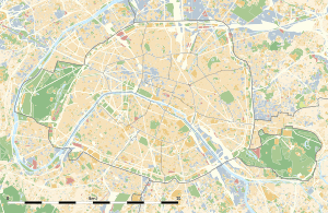
 Saint-Michel Location within Paris | |||||||||||||||||||||||||||||||
Saint-Michel is a station on Line 4 of the Paris Métro in the 5th arrondissement. Located in the Quartier Latin, it offers a connection to the St-Michel - Notre-Dame RER station on RER lines B and C. The platform lengths are 110 metres, longer than the 90–105 metre length of most line 4 station platforms.
The station was opened on 9 January 1910 as part of the connecting section of the line under the Seine between Châtelet and Raspail. It is named after the Boulevard Saint-Michel
Nearby attractions
- Île de la Cité
- Île Saint-Louis
- Notre Dame Cathedral
Station layout
| Street Level |
| B1 | Mezzanine for platform connection |
| Line 4 platform level | ||
| Northbound | ← | |
| Southbound | | |
Gallery
See also
- St-Michel – Notre-Dame (Paris RER)
References
- Roland, Gérard (2003). Stations de metro: D’Abbesses à Wagram. Éditions Bonneton. ISBN 2862533823.
External links
-
 Media related to Saint-Michel (Paris Metro) at Wikimedia Commons

