Saint-Liguori, Quebec
| Saint-Liguori | |
|---|---|
| Parish municipality | |
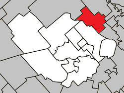 Location within Montcalm RCM. | |
 Saint-Liguori Location in central Quebec. | |
| Coordinates: 46°01′N 73°34′W / 46.017°N 73.567°WCoordinates: 46°01′N 73°34′W / 46.017°N 73.567°W[1] | |
| Country |
|
| Province |
|
| Region | Lanaudière |
| RCM | Montcalm |
| Constituted | July 1, 1855 |
| Government[2] | |
| • Mayor | Serge Rivest |
| • Federal riding | Montcalm |
| • Prov. riding | Joliette |
| Area[2][3] | |
| • Total | 51.80 km2 (20.00 sq mi) |
| • Land | 50.60 km2 (19.54 sq mi) |
| Population (2011)[3] | |
| • Total | 1,976 |
| • Density | 39.1/km2 (101/sq mi) |
| • Pop 2006–2011 |
|
| Time zone | EST (UTC−5) |
| • Summer (DST) | EDT (UTC−4) |
| Postal code(s) | J0K 2X0 |
| Area code(s) | 450 and 579 |
| Highways[4] |
|
Saint-Liguori is a parish municipality in the Montcalm Regional County Municipality in the Lanaudière region of Quebec, Canada.
Demographics
Population:[5]
- Population in 2011: 1976 (2006 to 2011 population change: 4.7%)
- Population in 2006: 1887
- Population in 2001: 1793
- Population in 1996: 1730
- Population in 1991: 1506
Private dwellings occupied by usual residents: 787 (total dwellings: 858)
Mother tongue:
- English as first language: 1.6%
- French as first language: 97.9%
- English and French as first language: 0%
- Other as first language: 0.5%
References
- ↑ Reference number 57076 of the Commission de toponymie du Québec (French)
- ↑ 2.0 2.1 Geographic code 63065 in the official Répertoire des municipalités (French)
- ↑ 3.0 3.1 Statistics Canada 2011 Census - Saint-Liguori census profile
- ↑ Official Transport Quebec Road Map
- ↑ Statistics Canada: 1996, 2001, 2006, 2011 census
External links
 |
Rawdon | Saint-Ambroise-de-Kildare | | |
| Sainte-Julienne | |
Saint-Charles-Borromée Saint-Pierre | ||
| ||||
| | ||||
| Saint-Jacques | Crabtree |
| ||||||||||||||||||