Saint-Léopardin-d'Augy
| Saint-Léopardin-d'Augy | |
|---|---|
|
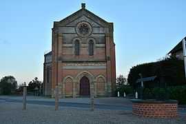
The church in Saint-Léopardin d'Augy | |
 Saint-Léopardin-d'Augy | |
|
Location within Auvergne region  Saint-Léopardin-d'Augy | |
| Coordinates: 46°41′02″N 3°06′17″E / 46.6839°N 3.1047°ECoordinates: 46°41′02″N 3°06′17″E / 46.6839°N 3.1047°E | |
| Country | France |
| Region | Auvergne |
| Department | Allier |
| Arrondissement | Moulins |
| Canton | Lurcy-Lévis |
| Intercommunality | Pays de Lévis en Bocage Bourbonnais |
| Government | |
| • Mayor (2008–2014) | Norbert Brunol |
| Area1 | 39.59 km2 (15.29 sq mi) |
| Population (2008)2 | 361 |
| • Density | 9.1/km2 (24/sq mi) |
| INSEE/Postal code | 03241 / 03160 |
| Elevation |
185–305 m (607–1,001 ft) (avg. 237 m or 778 ft) |
|
1 French Land Register data, which excludes lakes, ponds, glaciers > 1 km² (0.386 sq mi or 247 acres) and river estuaries. 2 Population without double counting: residents of multiple communes (e.g., students and military personnel) only counted once. | |
Saint-Léopardin-d'Augy is a commune in the Allier department in Auvergne in central France.
History
The commune is a result of the fusion of two previous towns (each from a parish of the Old Regime), St. Léopardin and Augy, by order of King Louis Philippe on June 18, 1843. During the French Revolution, the commune was called Vivier.
The name of St. Léopardin comes from that of a hermit, saint Léopardin, whose life seems just as legendary as that of St. Menoux. The priory of St. Léopardin is built where the hermit had lived.
Geography
The town is bordered by two rivers: the Allier, in the northeast and north, which forms its boundary with Chantenay-Saint-Imbert and Livry, and Burge, in the east, tributary of the Allier, which forms most of its border with the town of Aubigny.
Population
| Historical population | ||
|---|---|---|
| Year | Pop. | ±% |
| 1962 | 551 | — |
| 1968 | 590 | +7.1% |
| 1975 | 504 | −14.6% |
| 1982 | 436 | −13.5% |
| 1990 | 345 | −20.9% |
| 1999 | 328 | −4.9% |
| 2008 | 361 | +10.1% |
See also
References
| Wikimedia Commons has media related to Saint-Léopardin-d'Augy. |