Saint-Jean-sur-Erve
| Saint-Jean-sur-Erve | |
|---|---|
|
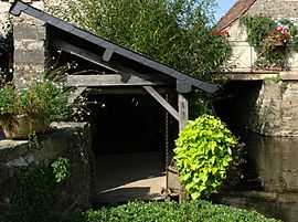
The washing house in Saint-Jean-sur-Erve | |
 Saint-Jean-sur-Erve | |
|
Location within Pays de la Loire region  Saint-Jean-sur-Erve | |
| Coordinates: 48°02′07″N 0°23′26″W / 48.0353°N 0.3906°WCoordinates: 48°02′07″N 0°23′26″W / 48.0353°N 0.3906°W | |
| Country | France |
| Region | Pays de la Loire |
| Department | Mayenne |
| Arrondissement | Laval |
| Canton | Sainte-Suzanne |
| Intercommunality | Erve et Charnie |
| Government | |
| • Mayor (2008–2014) | Solange Schlegel |
| Area1 | 25.39 km2 (9.80 sq mi) |
| Population (2007)2 | 489 |
| • Density | 19/km2 (50/sq mi) |
| INSEE/Postal code | 53228 / 53270 |
| Elevation |
58–119 m (190–390 ft) (avg. 70 m or 230 ft) |
|
1 French Land Register data, which excludes lakes, ponds, glaciers > 1 km² (0.386 sq mi or 247 acres) and river estuaries. 2 Population without double counting: residents of multiple communes (e.g., students and military personnel) only counted once. | |
Saint-Jean-sur-Erve is a commune in the Mayenne department in north-western France.
See also
References
| Wikimedia Commons has media related to Saint-Jean-sur-Erve. |