Saint-Jean-de-Dieu, Quebec
| Saint-Jean-de-Dieu | |
|---|---|
| Municipality | |
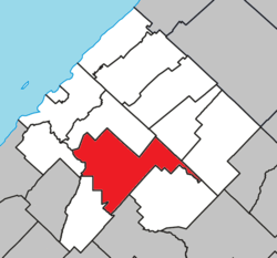 Location within Les Basques RCM. | |
 Saint-Jean-de-Dieu Location in eastern Quebec. | |
| Coordinates: 48°00′N 69°03′W / 48.000°N 69.050°WCoordinates: 48°00′N 69°03′W / 48.000°N 69.050°W[1] | |
| Country |
|
| Province |
|
| Region | Bas-Saint-Laurent |
| RCM | Les Basques |
| Constituted | January 1, 1865 |
| Government[2] | |
| • Mayor | Jean-Marie Côté |
| • Federal riding |
Rimouski-Neigette—Témiscouata —Les Basques |
| • Prov. riding | Rivière-du-Loup-Témiscouata |
| Area[2][3] | |
| • Total | 151.60 km2 (58.53 sq mi) |
| • Land | 151.02 km2 (58.31 sq mi) |
| Population (2011)[3] | |
| • Total | 1,606 |
| • Density | 10.6/km2 (27/sq mi) |
| • Pop 2006-2011 |
|
| • Dwellings | 740 |
| Time zone | EST (UTC−5) |
| • Summer (DST) | EDT (UTC−4) |
| Postal code(s) | G0L 3M0 |
| Area code(s) | 418 and 581 |
| Highways |
|
| Website |
www |
Saint-Jean-de-Dieu is a municipality in Quebec. The municipality had a population of 1,606 in the Canada 2011 Census.
The two main settlements within the municipality are the communities of Saint-Jean-de-Dieu and La Société. The settlement of Saint-Jean-de-Dieu was counted by Statistics Canada as a designated place in the 2011 census, separately from the boundaries of the municipality as a whole, and had a population of 935.
Demographics
Population
| |||||||||||||||||||
| Historical Census Data - Saint-Jean-de-Dieu, Quebec[6] | ||||||||||||||||||||||||||
|---|---|---|---|---|---|---|---|---|---|---|---|---|---|---|---|---|---|---|---|---|---|---|---|---|---|---|
|
|
| ||||||||||||||||||||||||
Language
| Canada Census Mother Tongue - Saint-Jean-de-Dieu, Quebec[6] | ||||||||||||||||||
|---|---|---|---|---|---|---|---|---|---|---|---|---|---|---|---|---|---|---|
| Census | Total | French |
English |
French & English |
Other | |||||||||||||
| Year | Responses | Count | Trend | Pop % | Count | Trend | Pop % | Count | Trend | Pop % | Count | Trend | Pop % | |||||
| 2011 |
1,570 |
1,570 | |
100.00% | 0 | |
0.00% | 0 | |
0.00% | 0 | |
0.00% | |||||
| 2006 |
1,580 |
1,565 | |
99.05% | 0 | |
0.00% | 0 | |
0.00% | 15 | |
0.95% | |||||
| 2001 |
1,710 |
1,710 | |
100.00% | 0 | |
0.00% | 0 | |
0.00% | 0 | |
0.00% | |||||
| 1996 |
1,765 |
1,720 | n/a | 97.45% | 35 | n/a | 1.98% | 10 | n/a | 0.57% | 0 | n/a | 0.00% | |||||
See also
References
- ↑ Reference number 56877 of the Commission de toponymie du Québec (French)
- ↑ 2.0 2.1 Geographic code 11010 in the official Répertoire des municipalités (French)
- ↑ 3.0 3.1 3.2 "2011 Community Profiles". Canada 2011 Census. Statistics Canada. July 5, 2013. Retrieved 2014-03-10.
- ↑ "2006 Community Profiles". Canada 2006 Census. Statistics Canada. March 30, 2011. Retrieved 2014-03-10.
- ↑ "2001 Community Profiles". Canada 2001 Census. Statistics Canada. February 17, 2012. Retrieved 2014-03-10.
- ↑ 6.0 6.1 Statistics Canada: 1996, 2001, 2006, 2011 census
 |
Sainte-Françoise | Saint-Médard | | |
| Saint-Éloi | |
Saint-Guy | ||
| ||||
| | ||||
| Saint-Clément | Saint-Cyprien | Sainte-Rita |
| ||||||||||||||||||||||