Saint-Hubert-de-Rivière-du-Loup, Quebec
| Saint-Hubert-de-Rivière-du-Loup | |
|---|---|
| Municipality | |
|
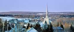
Westward view from Chemin Taché | |
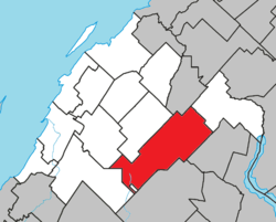 Location within Rivière-du-Loup RCM. | |
 Saint-Hubert-de-Rivière-du-Loup Location in eastern Quebec. | |
| Coordinates: 47°49′N 69°09′W / 47.817°N 69.150°WCoordinates: 47°49′N 69°09′W / 47.817°N 69.150°W[1] | |
| Country |
|
| Province |
|
| Region | Bas-Saint-Laurent |
| RCM | Rivière-du-Loup |
| Constituted | January 4, 1894 |
| Government[2] | |
| • Mayor | Napoléon Lévesque |
| • Federal riding | Montmagny—L'Islet—Kamouraska—Rivière-du-Loup |
| • Prov. riding | Rivière-du-Loup-Témiscouata |
| Area[2][3] | |
| • Total | 198.60 km2 (76.68 sq mi) |
| • Land | 191.69 km2 (74.01 sq mi) |
| Population (2011)[3] | |
| • Total | 1,235 |
| • Density | 6.4/km2 (17/sq mi) |
| • Pop 2006-2011 |
|
| • Dwellings | 989 |
| Time zone | EST (UTC−5) |
| • Summer (DST) | EDT (UTC−4) |
| Postal code(s) | G0L 3L0 |
| Area code(s) | 418 and 581 |
| Highways |
|
| Website |
www hubert-de-riviere-du-loup |
Saint-Hubert-de-Rivière-du-Loup is a municipality in Quebec in the administrative region of Bas-Saint-Laurent and the regional county municipality of Rivière-du-Loup.
See also
References
 |
Saint-François-Xavier-de-Viger | Saint-Clément | Saint-Cyprien | |
| Saint-Modeste | |
|||
| ||||
| | ||||
| Saint-Antonin / Whitworth (reserve) | Saint-Honoré-de-Témiscouata | Saint-Pierre-de-Lamy |
| ||||||||||||||||||